Towering 11,000-foot mountains, barren salt flats, sand dunes, deep canyons, expansive vistas and hidden oases make Death Valley National Park a hiker’s playground. Mild temps and the chance to see wildflower superblooms mean spring is the most popular time to visit, but autumn and winter offer equally pleasant weather and fewer people. Temperatures soar above 100 degrees Fahrenheit from May to September, though, and only experienced hikers prepared to deal with extreme heat should venture out during the day in summer. But with 3.4 million acres within the park boundaries, there’s plenty to explore whatever the season. Sound daunting? Don’t worry. We’ve rounded up ten of the best trails to get you started. From a short, educational boardwalk stroll to a challenging mountain summit, there’s something for everyone.
Salt Creek Interpretive Trail
-
- Location: 3.7 miles northwest of Beatty Junction, CA
- Length: 0.8-mile lollipop loop
- Difficulty Rating: Easy
- Best For: An educational and accessible walk
- Dogs: No dogs
This wide, ADA-accessible boardwalk winds along Salt Creek, which usually only flows through the barren salt flats of Badwater Basin in the winter and spring. The creek, which is surrounded by scrubby thickets of pickleweed and saltgrass, is the perfect place to try and spot the rare Salt Creek pupfish. Learn more about the small, sandy-colored fish from the interpretive signs along the route, or simply take in the panoramic views of Death Valley’s rugged hills and mountains.
Zabriske Point Trail
- Location: 4.9 miles southeast of Furnace Creek, CA
- Length: 0.3-mile out-and-back
- Difficulty Rating: Easy
- Best For: Iconic desert views
- Dogs: No dogs
No trip to Death Valley is complete without a stop at Zabriske Point. The short, paved path to the overlook means everyone can enjoy the 360-degree view of the surrounding badlands, including Manly Beacon and Red Cathedral, two prominent rock formations which soar above the region’s colorful canyons and hills. Time your visit for sunrise or sunset to catch the pink alpenglow on the distant mountains.
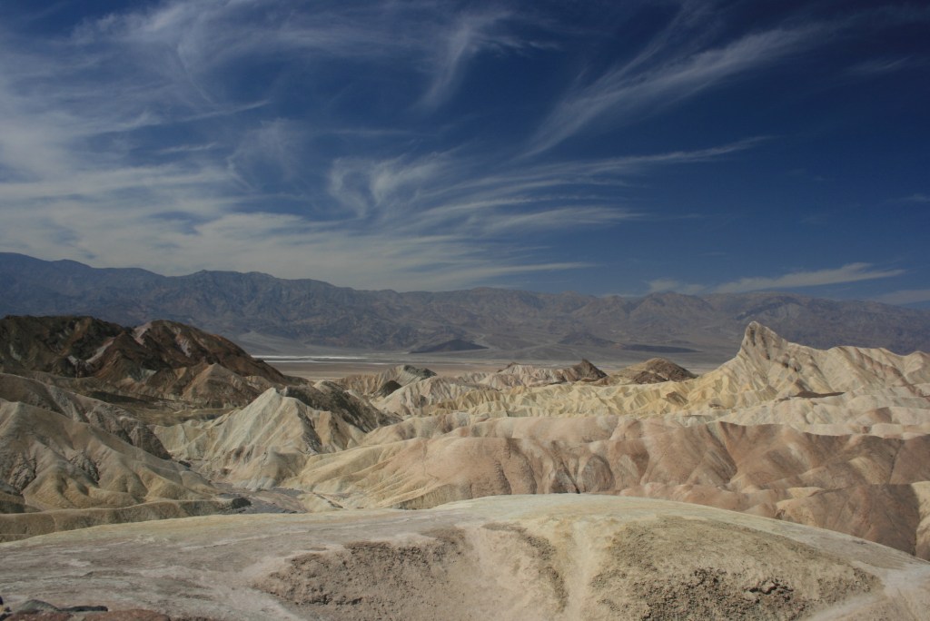
Zabriske Point (Photo Credit: Supermac1961 under CC BY-SA 2.0)
Darwin Falls
- Location: 3.3 miles southwest of Panamint Springs, CA
- Length: 2.1-mile out and back
- Difficulty Rating: Easy/intermediate
- Best For: A hike to a hidden oasis
- Dogs: No dogs
Darwin Falls is an unexpected oasis in the middle of the park’s vast badlands and salt flats. The trek to waterfall doesn’t follow a marked path, though, so you’re in for a bit of adventure with some easy scrambling and a couple creek crossings. The route is well-worn and easy to follow. You’ll hike from the desert into an increasingly lush landscape until you come to a pool where a rock splits the spring-fed, perennial waterfall in two like a wishbone.
Badwater Basin Crossing
- Location: 17.8 miles south of Furnace Creek, CA
- Length: 6.5-mile point-to-point
- Difficulty Rating: Easy/intermediate
- Best For: A below sea level adventure
- Dogs: No dogs
Located 282-feet below sea level, Badwater Basin is the lowest point in North America, and this trek traverses the heart of it. Though the first section is well-worn and easy to follow (most hikers turn back after the first half mile), the path eventually deteriorates into a rugged, way-finding journey. It’s up to you to set your sights on the western horizon and navigate the 200-square-mile, salt-encrusted plain. You can see for miles, and by heading west, you’ll eventually reach the West Side Road. Just be sure to arrange a shuttle or be prepared to head back the way you came.
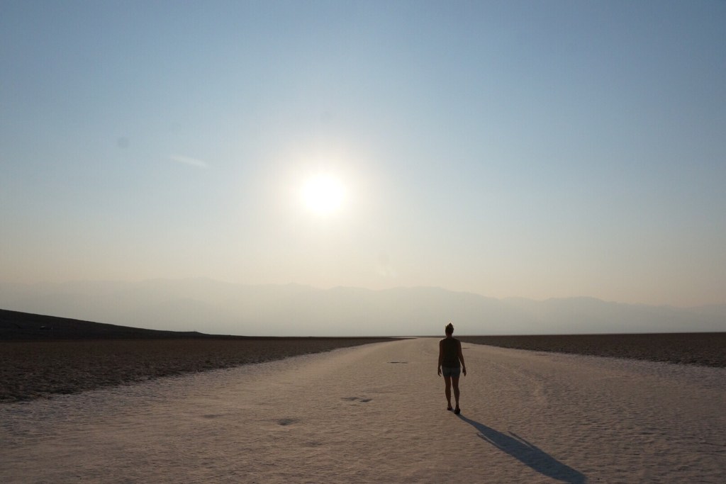
Badwater Basin (Photo Credit: Hiking Project contributor EHK)
Mosaic Canyon Trail
- Location: 2.5 miles south of Stovepipe Wells, CA
- Length: 3.6-mile out-and-back
- Difficulty Rating: Intermediate
- Best For: Exploring a desert canyon
- Dogs: No dogs
Mosaic Canyon, a narrow slot canyon through towering walls of polished marble, provides a stark contrast to the wide-open expanse of much of the park. The trek will get your heart pumping, too, as several sections of scrambling punctuate easy stretches of flat hiking along dry washes. On the return journey, be sure to stop and enjoy the view of the rippling Mesquite Flat Sand Dunes in the distance as you emerge from the canyon.
Red Cathedral Out-and-Back
- Location: 3.4-miles south of Furnace Creek, CA
- Length: 2.9-mile out-and-back
- Difficulty Rating: Intermediate
- Best For: Canyon hiking to rewarding views
- Dogs: No dogs
Explore a labyrinth of canyons as you gradually climb to the base of Red Cathedral, a wide band of rust-colored cliffs that tower above the path. On a blue-sky day, the contrasting colors of the yellow canyon walls and the red rock formation above you are fantastic, and in the winter and spring, there’s the added bonus of snow-capped, 11,049-foot Telescope Peak in the distance. You’ll follow a wide, sandy wash for much of the way, but there are a few sections of moderate scrambling. It can be slow going, but that just means you’ll have more time to soak in the canyon scenery.
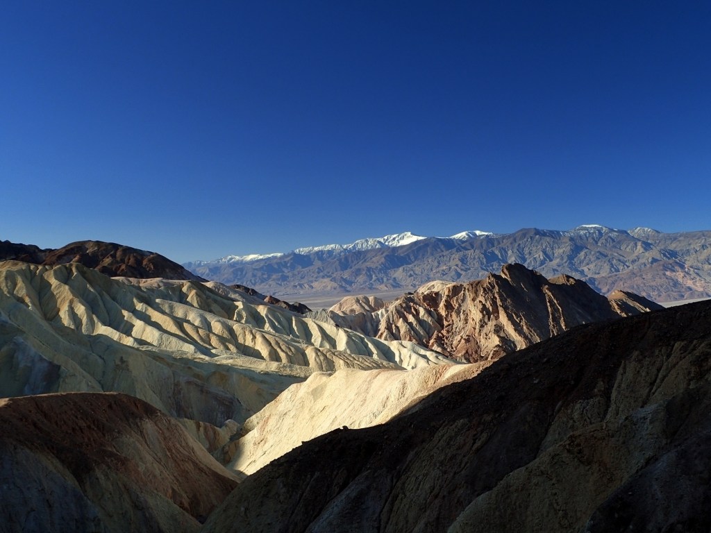
View from Red Cathedral Trail (Photo Credit: Hiking Project contributor Bruce Hope)
Ubehebe Crater Loop
- Location: 31.4 miles southeast of Crater, CA
- Length: 1.8-mile loop
- Difficulty Rating: Intermediate
- Best For: Views from the rim of a volcanic crater
- Dogs: No dogs
At 600 feet deep and nearly a half mile across, Ubehebe Crater is an unforgettable sight. The large depression, formed by a steam eruption, is a reminder of the powerful forces that shaped Death Valley. This walk along the rim gives you close-up views of the interior of the crater and nearby cinder fields. (Skip this exposed trail if you’re afraid of heights.) If you’re feeling up for a little more adventure and a lot more elevation gain, hike down the steep, 0.3-mile Ubehebe Crater Floor Trail. Just be sure to save enough energy for the 374-foot climb back out.
Desolation Canyon Trail
- Location: 5.5 miles south of Furnace Creek, CA
- Length: 3.7-mile out-and-back
- Difficulty Rating: Intermediate
- Best For: Panoramic views of mountains and salt flats
- Dogs: No dogs
Looking for a less-traveled outing? This unmarked trail through Desolation Canyon is a manageable cross-country trek. Route-finding is straightforward as you simply follow a sandy wash through the narrow ravine, eventually entering a designated wilderness area in the Black Mountains. The terrain becomes increasingly picturesque as you near Artist’s Palette, where oxidation has colored the rocks red, yellow, green and purple. If that isn’t enough, the out-and-back trek ends with a sweeping view of Death Valley and the distant Panamint Range.
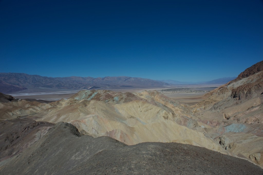
View from Desolation Canyon Trail (Photo Credit: Hiking Project contributor David Hitchcock)
Mesquite Flats Sand Dunes
- Location: 2.1 miles east of Stovepipe Wells, CA
- Length: Varied
- Difficulty Rating: Intermediate
- Best For: A choose-your-own adventure sand dune exploration
- Dogs: No dogs
The Mesquite Flats Sand Dunes are the best known and most easily accessible dunes in the park. See if you can spot the three main dune shapes—crescent, linear and star—as you explore the area. Take a flat, easy stroll along the base of the dunes or head out into the heart of them for a longer outing. These dunes are the only area of the park where sand boarding is allowed, so bring a sled (or an old snowboard or skis) for some downhill fun.
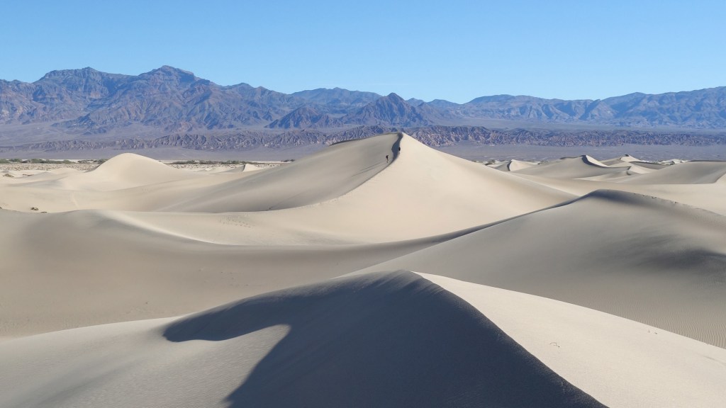
Mesquite Flat Sand Dunes (Photo Credit: Hiking Project contributor Matthew Kidd)
Telescope Peak Trail
- Location: 34.9 miles southeast of Panamint Springs, CA
- Length: 11.7-mile out-and-back
- Difficulty Rating: Intermediate/difficult
- Best For: Top-of-the-world views
- Dogs: No dogs
If you’re an experienced hiker looking for a high-altitude challenge, look no further than Telescope Peak. Topping out at 11,049 feet above sea level, the mountain towers above the basin below, and the hike takes you through a variety of terrain including forests of juniper and pines. You’ll want to come prepared for exposure and inclement weather, including wind and snow at the higher elevations, but for hikers up for a 3,000-plus-foot ascent, the views of the surrounding mountains and valleys are incomparable.
