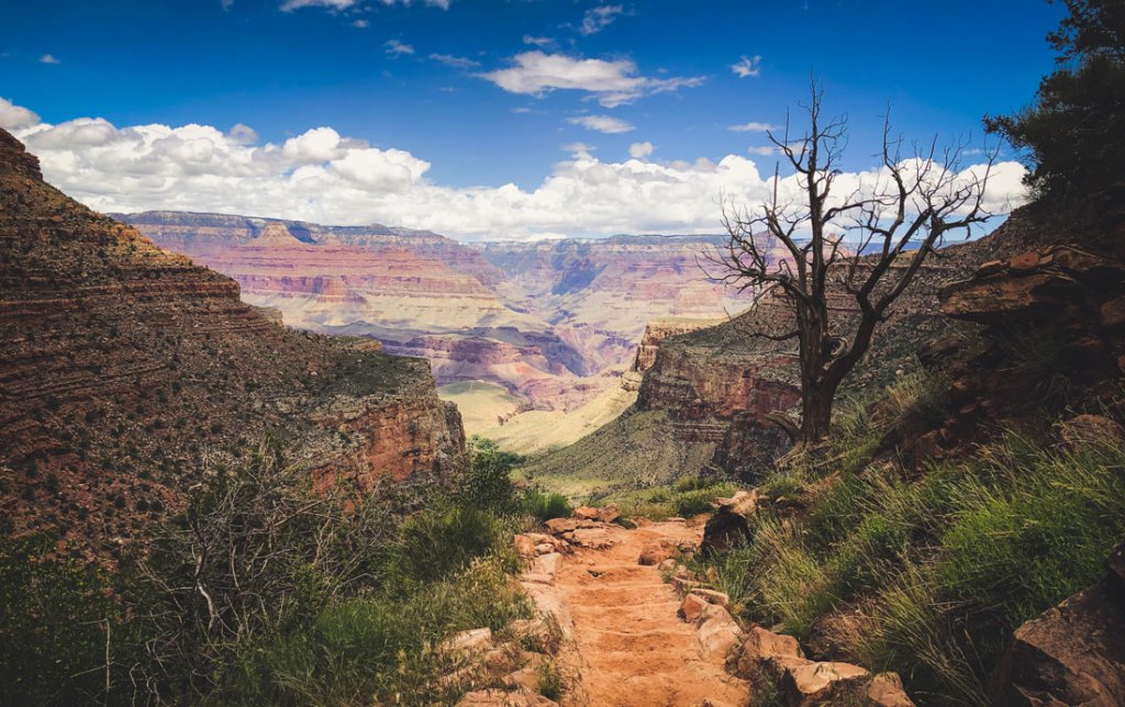
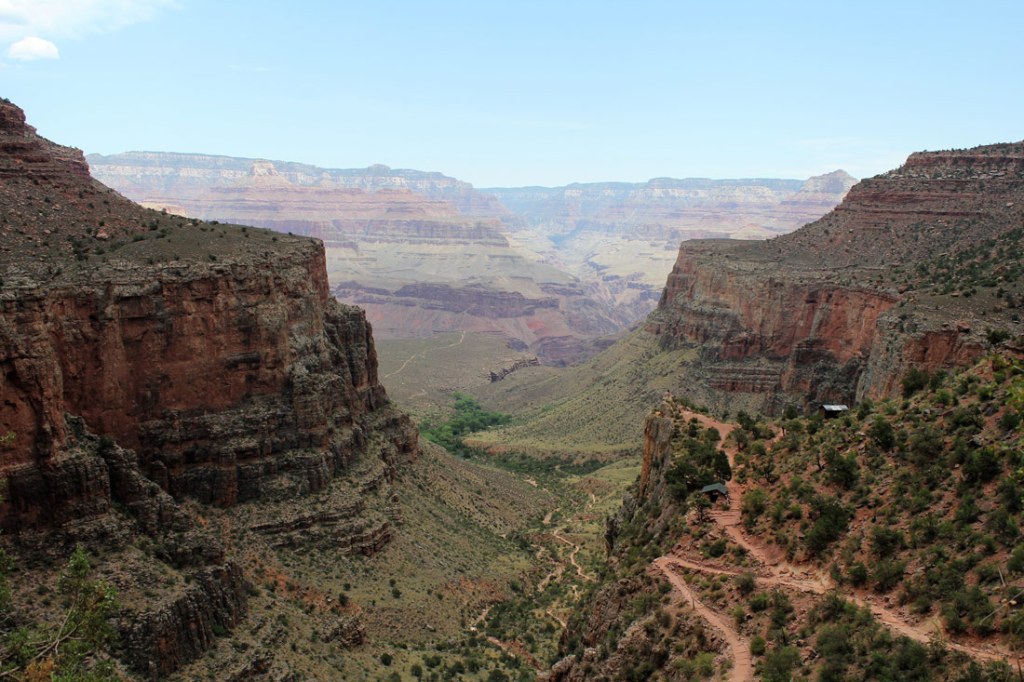
If it’s true desert wilderness you seek, then you can’t do better than the Grand Canyon, the crown jewel of the national parks system. Carved by water and chiseled by time, the mile-deep gash has enough mind-melting scenery to fill even the largest of memory cards. Twenty-mile views? Check. Soaring pinnacles? Check. Red rock buttes and hidden arches? Check. Secret oases, waterfalls and springs? You bet.
Which is to say, you could spend a lifetime ticking off hikes in Grand Canyon National Park. But for the best sampler, go rim to rim. Crossing the Big Ditch from one precipitous lip to the other scores you the best of both sides of the canyon, plus plenty of bragging rights: The easiest route is some 22 miles with more than 13,000 feet of elevation change. But the reward is some of the world’s most iconic scenery and unforgettable campsites. Here’s how to tackle our three favorite treks.
Routes
There are only two ways to cross the Colorado River on foot: the Silver Suspension Bridge and the Black Bridge, also called the Kaibab Suspension Bridge, both in Granite Gorge near Phantom Ranch. That limits the number of trails you can string together to go rim to rim, but in a park so big and so rough, a narrow scope is a welcome gift.
The North Kaibab Trail is the only option on the north rim, but you can choose between the Bright Angel or South Kaibab trails or a collection of lesser-known paths on the south side. The named three are corridor trails maintained by the park service; their signage is generally clear and each passes potable water sources and official campgrounds, making them a hair easier than non-corridor Grand Canyon trails (but still no joke).
Regardless of which route you pick, we recommend hiking north to south. The North Rim is taller than its twin, so you’ll lose elevation on a southbound trek. Plus, you can leave a shuttle vehicle near North Kaibab trailhead, allowing for easier logistics.
- North Kaibab Trail to River Trail to Bright Angel Trail
- North Kaibab Trail to South Kaibab Trail
- North Kaibab Trail to River Trail to Bright Angel Trail to Tonto Trail to Hermit Trail
North Kaibab Trail
All rim-to-rim crossings use this North Rim path. That’s not a bad thing; the North Kaibab Trail passes through every major ecosystem found between Canada and Mexico, and it’s far-and-away the least busy corridor trail. The flip side is, of course, that it’s a bear of a route, dropping more than 5,700 feet to the Bright Angel Campground in just 14 miles. Elevation change like that is hard whether you’re traveling uphill (ouch quads) or downhill (sorry knees).
Right off the bat, the views stretch across the canyon to the South Rim, where you can spy the topmost vermilion layer: billion-year-old limestone that used to be an ocean floor before plate tectonics had its way. (Brush up on your geology before heading out.) Cruise through Supai Tunnel, blasted through the red rock in the 1930s by the Civilian Conservation Corps near mile 1.8, then spend your first night on the trail at Cottonwood Camp near mile 6.9. Don’t miss the chance to cool tired feet in Bright Angel Creek before closing the first leg of your rim-to-rim journey at the silty Colorado River at mile 14.
After spending a night at Bright Angel Campground (or Phantom Ranch if you’re lucky enough to snag a reservation), choose your adventure up the opposite rim from the three options below.
North Kaibab to River Trail to Bright Angel Trail

Distance: 22.8 miles
Elevation change: 13,146 feet
Time: 4 days, 3 nights
Think Grand Canyon is just a barren desert? Think again. Tucked in Garden Creek Canyon, the Bright Angel Trail follows a fault line through lush riparian zones up the South Rim. Shocks of green foliage and golden cottonwoods pepper the route, providing habitat for ring-tailed cats (which are actually members of the raccoon family), toads, collared lizards and (literal) pack rats.
To get there from the Bright Angel Campground, cross the Colorado on the Silver Suspension Bridge and quickly pick up the River Trail. Trace the rapids west to where the River Trail merges with the Bright Angel Trail near mile 15.2. From there, the route climbs through the Pipe Creek drainage and a water-sculpted gully to Indian Garden, an oasis fueled by a perennial spring.
Camp at the Indian Garden Campground (mile 18.3) before closing out the trek on day four with 4.5 grueling miles up and out of the canyon.
North Kaibab Trail to South Kaibab Trail
Distance: 20.4 miles
Elevation change: 13,486 feet
Time: 3 days, 2 nights
From the Bright Angel Campground, you’ll head east along the river to the narrow Black Bridge. From there, cross the water and start your quest to go up, up and away. Beneath the blocky bluff of The Tipoff overlook (near mile 16), scan the rim to find Natural Arch, a small window through the red rock. It’s a good excuse to take a breather and steel yourself for the next push—more than a dozen steep switchbacks stand between you and the end of Cedar Ridge’s narrow finger. There, gain the ridgeline and scan east and west to see the Grand Canyon form a perfect V where the Colorado sluices through, like a gunsight to each horizon.
North Kaibab to River Trail to Bright Angel Trail to Tonto Trail to Hermit Trail

A switchback on the South Rim’s Bright Angel Trail.
Distance: 36.4 miles
Elevation change: 16,121 feet
Time: 5 days, 4 nights
This roundabout rim-to-rim route isn’t at the top of most hikers’ bucket lists—but it should be. Not only do you spend more time under the rim, you split from the corridor trails sooner, meaning you can score some solitude on the relatively unknown Tonto and Hermit trails.
Cross the Colorado River at the Bright Angel Campground, and head up to Indian Garden via the River and Bright Angel trails. Spend night three in the cool oasis before ditching the crowds by doglegging west onto the Tonto Trail. The path parallels the Colorado River for some 95 unmaintained miles, but you’ll follow it for just under 9 miles as it skitters around red rock spindles and past three reliable creeks and springs to Cedar Spring, a backpacking campsite with no amenities and an abundance of quiet.
On your last day, continue about 3 miles east, then take the Hermit Trail for the final 7-mile climb up the South Rim. The going is rough as the trail isn’t maintained (beware of rockslides), but you don’t have to dodge day hikers and mule poop. Plus, if you spin around, you’ll be greeted by some of the park’s grandest cross-canyon views.
Prep Work

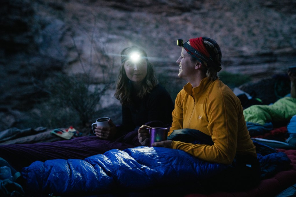
Hikers on a backpacking trip get ready to hunker down for the night.
Hiking a vertical mile down and back requires more than just a permit and some planning. The first step to a successful canyon crossing is good physical fitness. Make sure you’re comfortable hiking stairs or some steep local trails in a weighted pack, and if you’re not sure you’re up for the challenge, check out our guide to backpacking conditioning. Here’s everything else you’ll need to know.
Gear
Grand Canyon backpacking is a special breed. Be prepared. In addition to your Ten Essentials, strongly consider packing the following:
Extra water. The going is tough, shade is scarce and temperatures can creep into triple digits in summer. The NPS recommends carrying at least one gallon per person per day in warmer months, and you can learn more about hydration basics.
Salty, yummy snacks. Replenish sweat-lost nutrients with salty foods, and be sure to pack foods that you find extra tasty: Dehydrated hikers can lose their appetites.
Comfy, supportive shoes. Ankle support goes a long way on steep trails. Consider a mid-cut hiking boot, and be sure to put some miles on it before you head out.
Duct tape. Prepare for the worst blisters of your life. Cover hot spots with duct tape before they split, and read up on blister prevention and care.
Permits and Fees
Because the corridor trails are so popular, the park operates on a quota. That means while it’s tough to land a permit, if you do, you won’t be throwing elbows in a conga line to the Colorado.
For the best chance of snagging your desired trek, you’ll need to apply well in advance. You can submit your paperwork beginning on the first day of the month four months before your intended start date (apply on Jan. 1 for a trip in May, for example). Download an application, then mail it to the Grand Canyon backcountry office.
Backcountry permits cost $10 plus $8 per person per night. Check availability on corridor campgrounds here. Denied? You can try for a walk-in permit the day of your trip at the South Rim Backcountry Information Center, but it’s risky.
A stay at the historic Phantom Ranch on the banks of the Colorado starts at $65 for a dorm bed or $169 for a two-person cabin, but the inn’s home-cooked breakfast and dinner, sack lunches and icy beverages (including beer) can be purchased by everyone, even folks overnighting at the nearby Bright Angel Campground. Of course, luxury like this is reserved for the planners among us: For the best chance of scoring a coveted reservation, you must apply online up to 15 months in advance.
Shuttles
You can leave a car overnight in the North Kaibab parking lot or at the North Rim Lodge. (If you do the latter, take the free shuttle to the trailhead.) When you emerge at the South Rim, hitch a ride back to your vehicle on the Trans-Canyon Shuttle. It departs from the Bright Angel Lodge at 8am and 1:30pm every day mid-May to mid-October. The long and bumpy ride costs $90 per person.
