What four at-risk areas mean to those who love them most
Editor’s note updated July 10, 2017: The public comment period has closed.
The national commenting period on public lands closes on July 10, and Secretary of the Interior Ryan Zinke has already recommended reducing protections for Bears Ears National Monument. The review has put a spotlight on 26 more monuments, and these listed here are among the most beloved by mountain bikers, hikers, runners, and climbers. Here’s a look at why they were preserved in the first place as well as the adventure opportunities that exist within each.
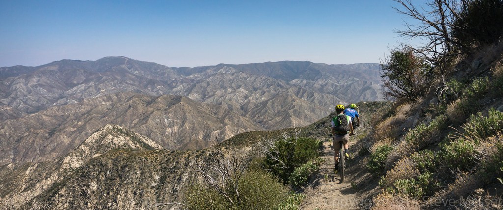
Ride: San Gabriel Mountains

Photo: Steve Messer
[Designated] 2014
[Acres] 346,177
[Miles of Trail] 200+
At the edge of the United States’ second largest concrete jungle, the San Gabriel Mountains are a treasured escape for Angeleños of the knobby tired persuasion. The monument’s peaks, which tower up to 10,000 above the nearby Pacific Ocean, are laced with steep dirt roads and raw, technical singletrack—a landscape where brake burning 4,000-foot descents are not only possible, they’re readily accessible.
“The rugged terrain and decomposed granite mean that these are some of the best, most technically challenging trails near any urban core,” says Steve Messer, President of L.A.’s largest mountain bike advocacy group, the Concerned Off-Road Bicyclists (CORBA). Messer is right on both fronts; the monument is home to some of Southern California’s highest-rated rides, all of which are located within 90 minutes of over 15 million people. His favorite outing? The 16-mile Strawberry Peak Loop which features cliff-side singletrack and offers riders a true backcountry experience just 20-minutes from the city’s urban edge.
“When I first came to Los Angeles in 1982, I didn’t know it was surrounded by mountains—you couldn’t see them through the smog,” recalls Messer. He soon found the mountains, though, picked up an early-era mountain bike and began a multi-decade love affair with their trails. “It’s the solitude you can find in remote high-country peaks, or along watercourses through the chaparral,” says Messer of the area’s draw.
The San Gabriel Mountains account for more than 30 percent of the city’s drinking water and represent roughly 70 percent of its available open space, so it’s no wonder Angeleños overwhelmingly support the increased protections associated with the national monument designation. “It’s funneled additional resources to the area and has brought together many people who have an interest in these mountains,” says Messer. “We’re seeing efforts to increase access for the disadvantaged and there’s more interest in a sustainable future for the mountains.”
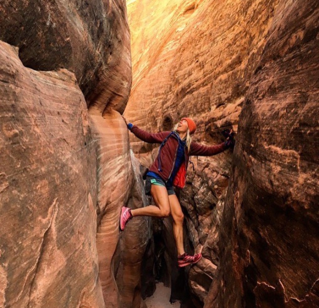
Run: Grand Staircase-Escalante

Photo: Morgan Sjogren
[Designated] 1996
[Acres] 1,880,461
[Longest Slot Canyon] 30 miles
Grand Staircase-Escalante National Monument contains 1,880,461 acres of some of the most remote and varied terrain for runners to explore in southern Utah. From high desert forests to an underworld maze of slot canyons, it would take more than a lifetime to travel through the fine details of this desert arena on two feet. The monument was established under the Antiquities Act in recognition of its rich historic artifacts including petroglyphs, pictographs and ancient Moki Steps.
“During a 24-hour adventure in Grand Staircase-Escalante, I rappelled 150 feet into a slot canyon that held a 1950s truck wedged between its walls, ran 30 miles down Buckskin Gulch (the world’s longest continually narrow slot canyon), pranced straight through the Paria River, stopped in awe at the intricate panels of rock art and slept peacefully under a full moon shining bright along the sandstone cliffs of Coyote Buttes,” says elite trail runner Morgan Sjogren.
Grand Staircase-Escalante is abundant with both dinosaur fossils and ancient human artifacts. More than 200 species of birds, 60 species of mammals and dozens of types of reptiles call the monument home. “It encapsulates some of our country’s most unique wilderness and geological features,” says Sjogren. “I can only imagine the magic yet to be revealed in this special place if I were to spend just one more day within the monument.”
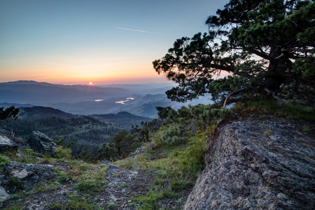
Hike: Cascade-Siskiyou

Photo: BLM, Flickr
[Designated] 2000
[Acres] 86,774
[Species of Birds] 200
Cascade-Siskiyou National Monument of southwestern Oregon and northwestern California features mossy forests, the snowcapped Mount Shasta and the remains of an ancient volcano, Pilot Rock. Nineteen miles of the Pacific Crest Trail run through the monument, bringing backpackers and hikers to enjoy its remote wilderness.
“The dense northern forest and lack of development throughout the area were evident on my hike through the monument in 2014,” says Steven Shuttuck, who’s hiked over 12,000 miles in the last decade and thru-hike the PCT. “I specifically remember being on a forested ridgeline, looking south over the Seiad Valley and viewing a strong electrical storm quickly approaching before the hikers I was with and I all ran down the ridge a few hundred feet and perched under a pine.”
As the first national monument to be designated in the name of biodiversity preservation, Cascade-Siskiyou is home to a number of rare amphibians and birds, including the endangered great grey owl. The Siskiyou Mountains are 425 million years old, but the volcanic Cascade Range is much younger, resulting in a wide variety of soil types, geology and vegetation.
“It’s free, wild and public,” says Shattuck. “Protecting this land protects the corridor of the PCT, and will keep it wild and free for future generations.”
Climb: Bears Ears

[Designated] 2016
[Acres] 1,351,849
[Climbing Routes] 1,258
This eye-popping expanse of fractured sandstone cliffs and winding canyons tucked between Utah’s Canyonlands National Park and the goosenecks of the San Juan River is not only home to crack-climbing mecca Indian Creek but also to an estimated 100,000 archeological sites. Scattered amongst the area’s quintessential southeast Utah terrain are ancient dwellings, granaries, petroglyphs, kivas and more, many in pristine condition and easily hiked to. The area is considered sacred to tribes such as the Navajo, Ute, Hopi, Uinitah and Ouray, and was designated a national monument in 2016 in collaboration with tribal governments to preserve its rich cultural history and diverse geography.
Climbers flock to “the Creek” to sink their hands into the perfect cracks that pepper the walls, known as “splitters,” and to test their mettle on desert towers like the classic South Six Shooter. Mountain Project has more than 1,200 routes within Bears Ears listed in its database, but there are surely many more than haven’t been contributed.
Conservationists fear that Secretary of the Interior Ryan Zinke’s recent recommendation to reduce the acreage protected under Bears Ear’s national monument status would threaten biodiversity, while climbers are concerned they’ll contend with oil to climb and camp. Indian Creek is at the top of many a climber’s tick list, and has become a seasonal stop for road tripping climbers, particularly for “Creeksgiving.”
“This area is sacred to many parties for many reasons,” says climber and videographer Alton Richardson. “It’s hard to imagine this land being anything but protected from extraction. Even with the popularity of climbing in the area, there are vast stretches of land here that will remain pristine and unchanged. But only if it remains that, pristine and unchanged.”


