Last August I had the opportunity to participate in a three-day, 150-mile bike trip and photo shoot through southwest Washington with Novara Bikes, an REI brand. We traveled dirt roads, rolled through lush forests and were rewarded with amazing and wild views. Here’s my story.
Day 1: Randle to Trout Lake, WA
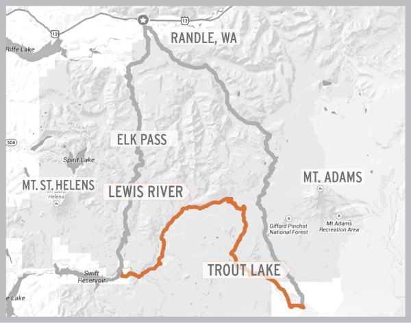
As I rolled into the small town of Randle, packed for three days of biking and camping, I started to realize how remote this trip was going to be. I felt a little nervous, but mostly excited, for what was to come. The launching point for this adventure was a large gravel parking lot on the southeast corner of Highway 12 and 131. After everyone arrived, we had a quick meeting outlining the ride for the day and what to expect. The plan was to head south on Highway 131, take a quick left-hander onto Cispus Road which turns into NF-23, then follow this all the way to Trout Lake, about 60 miles away. After gathering and packing all our gear, we were off, 10 riders in all.
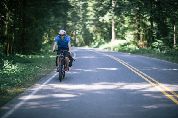
The first 20 miles were pretty relaxed with a moderate grade, but anyone who has ridden with a group of people knows that every rider has a different pace. After a couple of miles I found myself riding alone, which I was perfectly fine with and actually enjoyed. After a while I met up with Brad, who seemed to share my tempo, and we ended up riding most of the three-day route together. The moderate climb was nice, but before long it wasn’t so moderate. We started to climb and the pavement gave way to gravel. The gravel road got a little steeper, the sun a little hotter, and I could tell I needed to eat something. We found a shady spot to rest and grabbed some food and water to refuel.
Feeling revitalized and enjoying the break from the sun, we decided to push on. In a few minutes we came across a meadow with no one else in sight. It seemed wrong to pass up such a picturesque scene, so we decided it was a good place to stop and reconnect with the rest of our group. After re-grouping and sharing stories of the last couple hours, it was time to move on. We were told that the crux for the day, Babyshoe Pass, was just around the corner . The oddly named pass revealed sweeping views and led to a steep descent. Finally!
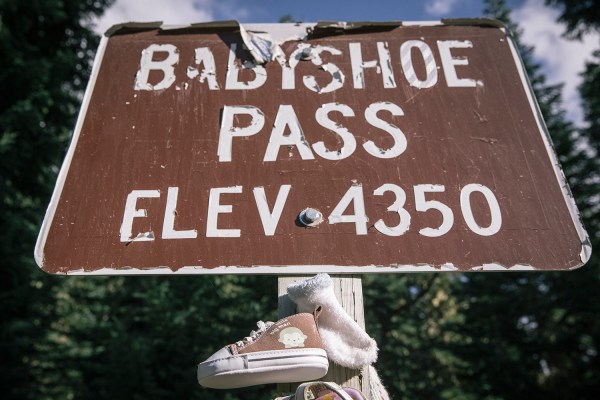
Being a die-hard mountain biker, this is what I live for. We still had a ways to go, but I couldn’t help myself and decided to go for it. Crushing gravel roads at 40 mph with 30 pounds of gear on my bike was a little sketchy, but with 40c tires, a steel frame and disc brakes the Mazama handled it like a champ. Despite the washboards, loose gravel and high speed, I made it down in one piece with a smile on my face. Back on pavement the adrenaline rush was over, but at least I could feel my hands again. We still had a ways to go for the day and it was time to reel it back in a bit, pick the bugs out of my teeth and enjoy the massive views of Mount Adams.
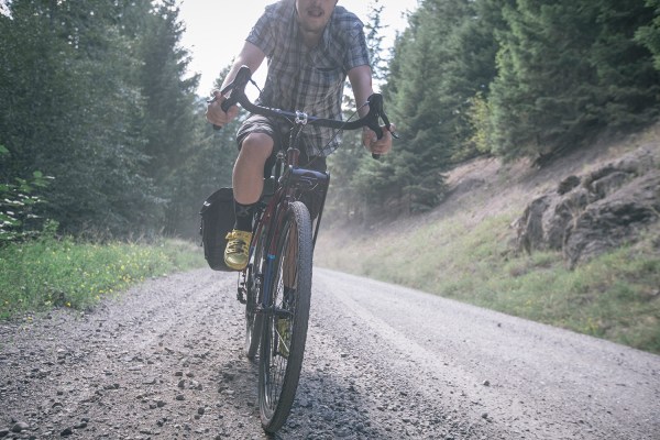
With only a couple more hours of daylight and 20 miles to cover, we had to keep moving. The rest of the day was mostly downhill and it was easy to maintain a good pace. We eventually rolled into Guler Mount Adams County Park, our camp spot for the night. It felt good to unclip and know we were done for the day. One by one, people started to arrive and you could tell everyone was excited to get out of the saddle. After a much-needed dip in the local stream to cool down and clean off, we headed to the local café for dinner. To say that the food hit the spot would have been an understatement.

As I lay in my tent that night thinking about the day, I replayed all of the spectacular views I had witnessed. From rolling, tree-lined roads to subalpine meadows and views of Mount Adams, there was certainly no shortage of wild scenery. One of the best moments was when we were stopped about five miles outside of Trout Lake. The sun was low on the horizon and projected a golden light on the fields around us. Those fields led to the forest and beyond that, Mount Adams. I think that sometimes as cyclists we don’t take the time to enjoy and appreciate the reasons we started riding bikes in the first place, for the freedom and sense of independence it brings us. We tend to get caught up in the competitive nature of racing and training within our sport and forget about the simple pleasures of riding. As I prepare for the upcoming race season, I hope I can hang onto the feeling I had while on this trip of everything falling back into proper perspective.
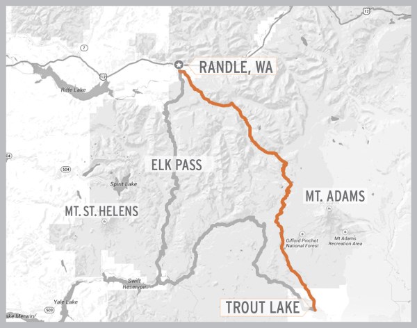
Stats for day 1:
- Distance traveled – 57 miles
- Feet climbed – 5,200
- Elapsed time – 6 hrs. 50 min.
- Moving time – 4 hrs. 40 min.
- Calories burned – 3,400
- Average moving speed – 12.2 mph
- Max speed – 43.6 mph
Day 2: Trout Lake to Swift Reservoir, WA
Day two of our adventure started with me lying in my tent imagining cramped legs, an aching back and a sore neck. I almost didn’t want to move, and all I could think about were my quads yelling at me because of the ride the day before. I slowly began to move, inch by inch, and was pleasantly surprised to find that none of this was true. Perhaps it was the fresh air altering my state of mind, or maybe it was the fact that I was spending another work day on my bike. Either way I felt unexpectedly spry and also thankful. I unzipped my tent to see a few others starting to stir and figured I should get ready for the day. The plan was to pack everything up and head back to our favorite café in town for breakfast. Looking around the table you could tell that everyone was a little tired, but most were wearing a smile and in good spirits, excited for what the day would bring. After stuffing our faces, it was time to head out.
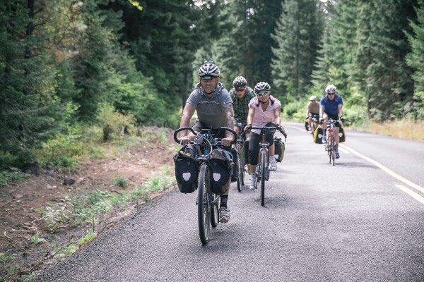
Our destination was Swift Reservoir, about 40 miles away, with less climbing than the day before. We headed west out of town on Highway 141 and took a right onto Trout Creek Road. With an early start and only 40 miles to cover, there was no reason to hurry, so we enjoyed riding together for the majority of the day. We got to talk, socialize and have fun as a group.
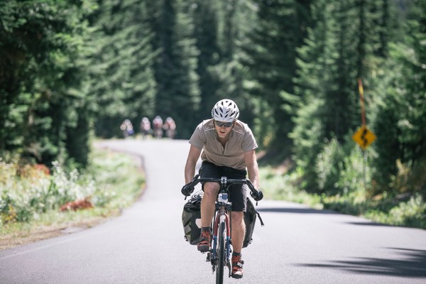
After about two hours of riding, we came to Big Mosquito Lake, our planned lunch stop for the day. Luckily for us, the lake did not live up to its name, and we enjoyed a nice break in the sun as we ate lunch bug-free. We soon pushed on, reached the summit for the day and started to descend. Before long the pavement transitioned to gravel, and we found ourselves chattering down the road. The gravel wasn’t as good as the day before; it was full of nasty washboards and loose sections that would suck you in. We had to keep our speed in check a little more to stay upright, while stopping occasionally to shake out our hands to regain feeling.
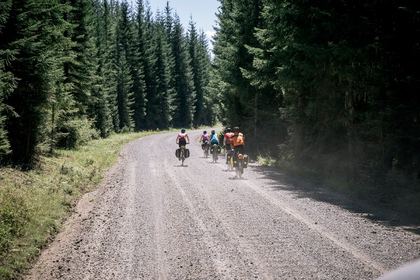
After the long, somewhat jarring descent, we reached the bottom of Curly Creek Road. We regrouped again, making sure everyone made it down in one piece. From here we took a left on NF-99 leading us to our campground for the night, only four miles away. It was 80 degrees by the time we rolled into camp, and I was ready for a nice swim. After ditching our gear at the campsite and unloading our bikes, everyone headed down to the river. The water was absolutely freezing, but it felt refreshing to give my legs an ice bath and cool down after a hot day. After getting our fill, we headed back to the campsite to set up our tents and get started on dinner.
Before dinner I had to make one more trip down to the river to try my luck at some fishing. I’ve been fly-fishing for nearly 20 years, and anytime I’m near a river it’s impossible for me to not read the water and look for fish. I had secretly, or not so secretly, been scouting the river when we were swimming, looking for rising fish. I fished the pocket water pretty hard, slowly moving my way upstream, but had no luck at first. I decided to wait it out though, and eventually landed and released three good-sized rainbow trout by headlamp. Anyone who has fished into the fading light knows how hard it is to leave when you are catching fish, but my stomach was growling and it was time to return to camp.
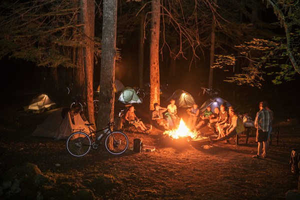
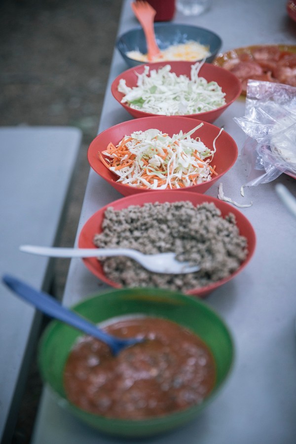
The sound of laughter, the light of a campfire and the smell of tacos guided me back to our campsite. What a great way to end the day.
Stats for day 2:
- Distance traveled – 40 miles
- Feet climbed – 2,800
- Elapsed time – 4 hrs. 20 min.
- Moving time – 3 hrs. 5 min.
- Calories burned – 1,800
- Average moving speed – 11.7 mph
- Max speed – 48.8 mph
Day 3: Swift Reservoir to Randle, WA
The last and final day of the journey was here, but it was far from over. Everyone packed up quickly, ready to get on the road. We grabbed breakfast, filled up our bottles and were off. Today we would take a right out of the campground, cross the river we swam in the day before, and take another right onto NFD 25. We would follow this back to Randle, completing our adventure.
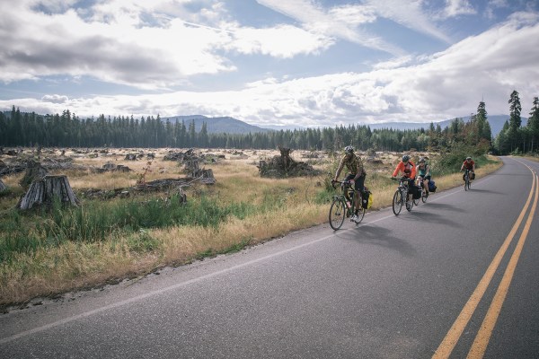
There were 45 miles and 4,500 feet of climbing standing between us and Randle. Starting off in the shade made for a chilly morning, but with two brutal climbs ahead, I decided to hold off on extra layers. With no warm up and 2,000 feet of climbing, the five miles to the top was a real punch in the face. This split the group up pretty quickly, and luckily I was able to hang with three other riders. We formed a bit of a pace line and took turns pulling each other up. The climb wouldn’t have been that bad if we were just out on a road ride, but when you’re towing 30 pounds of gear and with 100 miles of fatigue in your legs, it takes a little out of you. We kept rolling along, though, and made it through. We felt the relief of knowing the hardest part was done and stopped to enjoy the view. We had a bit of a false flat followed by a quick descent before tackling the next climb. This proved to be less steep, but seemed to last just as long. We all made it though and rested for lunch at the summit of Elk Pass. The climbing part of the trip was over, and you could tell everyone was excited for what was to come next.
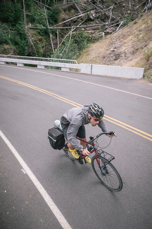
It was hard to contain my excitement for the 15 miles of descent. I finished up lunch, threw on a jacket and was ready to roll. Soon enough the road pointed down and we were off. If 30 minutes of pure unadulterated descending doesn’t put a smile on your face, then I don’t know what will. Taking full advantage of every sweeping turn and downhill pitch, I managed to hit 55 mph with a full tuck. This was a well-deserved descent, and I think the term “earn your turns” would be appropriate here, for we all certainly deserved those downhill turns.
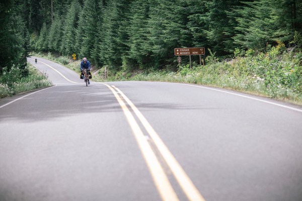
The steep grade flattened out as we neared Randle, and it was time to spin it out, cooling down for the day and taking in the last moments of the ride. As we cruised into Randle, I think each and every one of us felt a huge sense of accomplishment mixed with a little bit of relief.
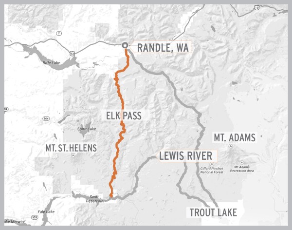
Stats for day 3:
- Distance traveled – 46 miles
- Feet climbed – 4,500
- Elapsed time – 4 hrs. 55 min.
- Moving time – 3 hrs. 15 min.
- Calories burned –2,500
- Average moving speed – 14.3 mph
- Max speed – 54.1 mph
Trip Reflections
Memories from the trip flood my mind as I look at maps and images from our ride and write these closing paragraphs. The end of a trip like this can be quite thought provoking; we covered a lot of distance, saw some of the best scenery in Washington, and made a few new friends. Sometimes you don’t fully realize the impact of a trip until weeks after, when you have downtime to reflect. That has certainly been the case for me and every once in a while something reminds me of how I felt bombing that gravel road or rolling along those sun-drenched fields. It takes me back to the feeling of adventure I had and I start to plan the next trip, where I will once again find that feeling of freedom and renewed perspective.
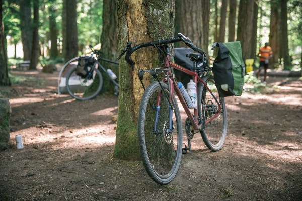
With a little bit of knowledge, some cycling fitness, and planning, anyone can make this trip happen. We were a group of cyclist with little-to-no gravel grinding or bike touring experience, yet we made it through and had a great time along the way. I encourage, or rather challenge you, to take the initiative to plan a trip like this. Even if it is only for one night, you’ll be surprised by the adventures that present themselves and the memories you’ll make.
