An essential summer experience? Hiking to an alpine lake. These five are in their prime.
There are few more sublime pleasures than arriving at an alpine lake after a long day on the trail. A water’s-edge picnic, skipping stones and feeling the cool breeze off the water are all feathers in a hiker’s cap. With a myriad of mountain ranges crisscrossing the American West, thousands of alpine lakes have been carved into the untamed wilderness over several millennia. Here are five of the most Insta-worthy lake trails. The prime time to hike them? Right now, when the temps are still comfortable—even at 11,000 feet—and before the snow hits again.
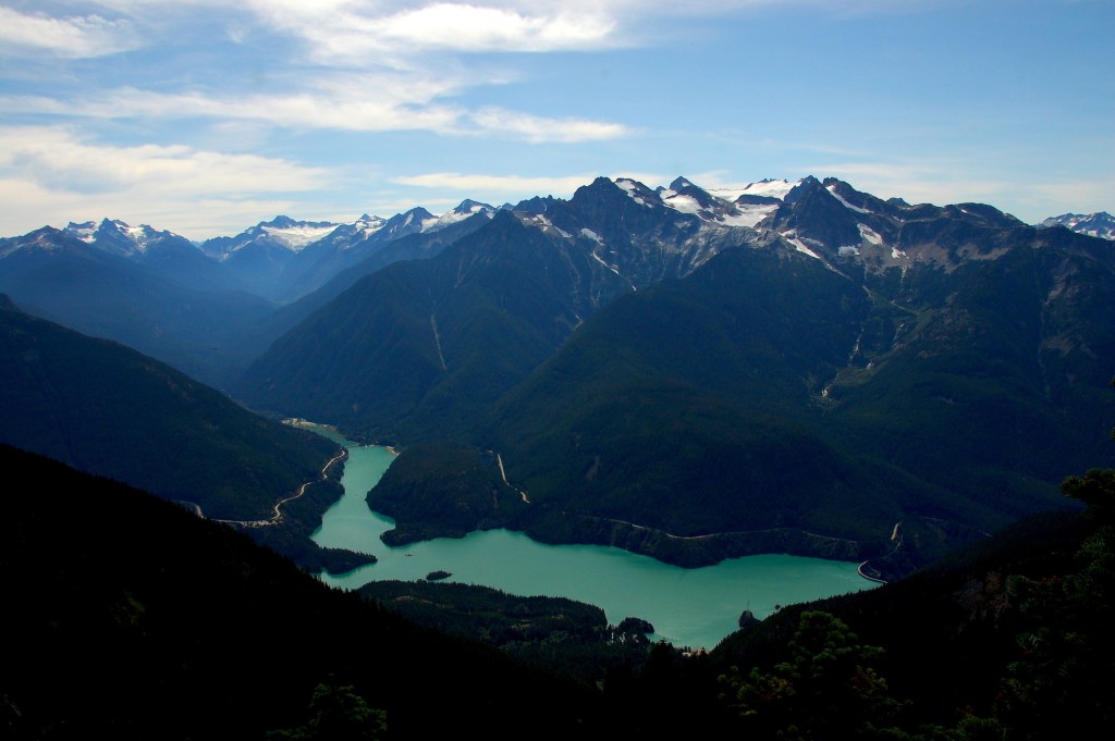
Diablo Lake
Where: North Cascades National Park, Washington
Distance: 3.7 miles
Difficulty: Intermediate/Difficult

Photo: Steve Cyr, Flickr
Mount Rainier National Park, home to Washington’s tallest peak, receives 1.9 million visitors per year, and Olympic National Park, famous for its foreboding rainforest, attracts 2.8 million. But the Evergreen State’s third national park hosts one of the region’s most scenic alpine lakes—minus the crowds: Deep within North Cascades National Park, which sees just 29,000 visitors per year, is the Diablo Lake Trail. On the trail, you’ll gain roughly 1,000 feet over the course of 3.7 miles, pass cascading waterfalls and take in clear views of a variety of peaks.
Your first glimpse of glacially-fed Diablo Lake comes about 1.5 miles in. There, a short side trip under the transmission lines leads to a vista overlooking its blue-green waters above its north shore. As you continue, you’ll spy Pyramid, Snowfield, Davis and Colonial Peaks rising above the treeline. You’re getting close to the turnaround point once you’ve started the switchbacks 600 feet down to a suspension bridge near Ross Lake. Enjoy the views of Ross Lake Dam before turning around.
Sky Pond
Where: Rocky Mountain National Park, Colorado
Distance: 8.3 miles
Difficulty: Intermediate/Difficult
You’ll have to work to enjoy the beauty of Sky Pond in Rocky Mountain National Park. But if you’re not put off by the ascent—hikers gain 2,000 feet over four miles—or the rock scramble near the hike’s end, you’ll be rewarded with a lake that’s surrounded on three sides by sheer rock walls.
The first four miles start easily, snaking through thick pine forests and passing the 30-foot-tall Alberta Falls before reaching Timberline Falls (also roughly 30 feet tall). To continue to Sky Pond, climb a chute next to the waterfall, which requires a steep, 100-foot, Class 3 rock scramble.
Once beyond Timberline Falls, you’ll arrive at the stark Lake of Glass almost immediately. Cross some granite slabs westward along the shore, and you’ll arrive at the foot of Taylor Glacier. Here, Sky Pond sits at nearly 11,000 feet. Take in views of Taylor Peak, Powell Peak and the Sharktooth, all over 12,000 feet tall, surrounding you and the alpine lake.
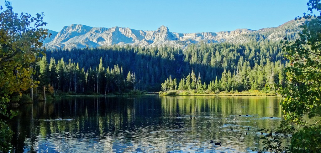
Twin Lakes
Where: Mammoth Lakes, California
Distance: 3.2 miles
Difficulty: Difficult

Photo: Don Graham, Flickr
Twin Lakes is actually one lake: two larger bodies of water connected by a narrow channel. It’s also the only lake in the Mammoth Lakes Basin accessible by car, but why drive when you can hike to it along the Dragon’s Back/TwinLakes Trail?
The trail begins at the summit of 11,000-foot-tall Mammoth Mountain and follows the steepest and shortest path down the mountain. Descend 2,500 feet as you work your way toward the lake. Less than a mile before the bottom, look for the Bottomless Pit, a lava tube chute that attracts skiers in the winter. Continue through the pine forest until you hit the lake. Twin Lakes isn’t a secret—there’s even a wedding chapel near its shore—but the sights along the trail are some of the most scenic in the region.
White Pine Lake
Where: Salt Lake Valley, Utah
Distance: 5.2 miles
Difficulty: Intermediate/Difficult
White Pine Trail passes through alpine forests and features several water crossings. With thick, tall pines lining the trail, you’ll have plenty of shade as you make your way toward the water. After four miles, the path will open up to a basin. Look to the southwest, and you’ll see the pass that drops quickly down to White Pine Lake.
Want to keep going? Continue on the Red Pine Lake trail, which will add an additional 2.3 miles onto your trek and take you to another remote alpine lake. The trail ends at the northern edge of Red Pine Lake, surrounded by wildflowers each summer, thickets of trees and sheer cliff walls. From here, you can continue to Upper Red Pine Lake (via a rough, unofficial trail along the stream flowing into Red Pine Lake) or make the 1.5-mile climb to the top of the Pfeifferhorn, a scenic summit more than 11,000 feet above sea level.
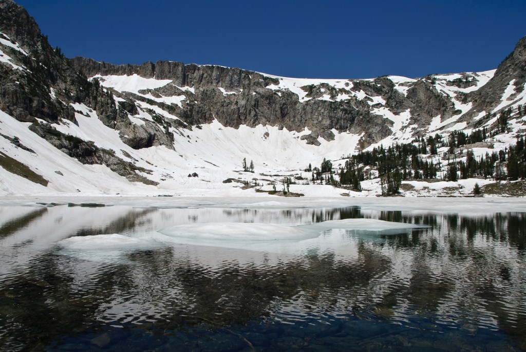
Lake Solitude
Where: Grand Teton National Park, Wyoming
Distance: 14.2 miles
Difficulty: Intermediate

Photo: Marshal Hedin, Flickr
If you only have time for one hike in Grand Teton National Park, this is it. The Lake Solitude trail is an all-encompassing tour of the park’s myriad highlights, including lakes, a waterfall and vistas of the surrounding Tetons.
The 14.2-mile round-trip trail to the remote alpine lake follows one of the most impressive canyons in the United States, flanked on either side by dramatic mountains: Teewinot, Owen, the Jaw and Rock of Ages. Just before the trail turns north, you’ll hit the booming 100-foot-tall Hidden Falls.
As you continue, take in the views of the popular Jenny Lake and the surrounding Tetons from Inspiration Point. Keep an eye out for the elk and moose that call this region home, and guard your pack from marmots if you wander. Once you arrive at Lake Solitude (which remains icy well into the summer), you’ll enjoy sweeping views of Teewinot Mountain, Mount Owen and Grand Teton. Pack plenty of layers. While heavenly on the best days, it can snow here any time of year—and at this elevation, winter’s deep is but weeks away.
