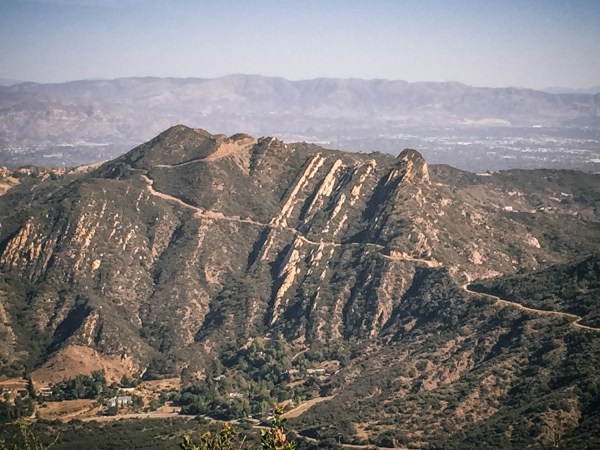
The Backbone Trail begins on Sunset Boulevard in Santa Monica, an urban hub known more for its high-end hotels, Hollywood starlets and hip cafes than its long-distance hiking trails. But at Will Rogers State Historical Park, just off Sunset, this iconic designated hiking trail begins.
The trail stretches some 65 miles across national and state park lands, as well as local conservancy land. It’s filled with oak woodlands, creeks and valleys along the ridgeline of the Santa Monica Mountains, before coming to an end at Point Mugu in Ventura County.

From the trail, you can look south to the Malibu coastline and north toward the San Fernando Valley, Conejo Valley and Oxnard Plain. For the first five miles, when you look to the east, you’ll get a bird’s eye view of downtown Los Angeles. “The trail corridor is nested in wild parkland, some of it even designated as Wilderness Area, but it’s surrounded on three sides by millions of people,” says Arthur Eck, executive director of the Santa Monica Mountains Fund, which was established in 1988 to support the National Park Service in the promotion of the Santa Monica Mountains National Recreation Area, the country’s largest urban national park.
The Backbone Trail, named for its spine-like route along the crest of the mountains, was first envisioned in the 1970s, and with help from a collaboration of agencies, 62 miles of the trail were completed by 2010. But two sections of the trail—which, together, make up about three miles—have remained incomplete.
Future funds, including those provided via REI’s Every Trail Connects efforts, will be used to improve the Backbone Trail experience and make it more sustainable. Some portions of the 67-mile-long trail have significant erosion from past storms. To address this, they will be repairing retaining walls, adding grade dips and other drainage features, and repairing the trail tread. To improve the visitor experience, they will be naturalizing some of the unofficial trails that have sprung up and are causing confusion about wayfinding.
The trail is used by hikers, trail runners, backpackers (it takes most people about three days to hike the entire trail) and in some sections, mountain bikers and horseback riders. Don’t be fooled by the trail’s beachside origins: This is a mountain-climbing route. “You’re going from sea level up to 3,000 feet and back down again,” says Eck. “It’s a challenge, but it’s not unforgiving.”
Once the two final sections are complete, hikers will be able to seamlessly connect the entire trail, which also links up to other nearby trail systems. The best time of year to go? Suggests Eck, “Go in the spring, a favorite time to hike the trail, when the mountains are covered by one of the most diverse display of wildflowers anywhere in the U.S.”
REI will donate $5.9 million in 2015 to help care for and increase access to more than 1,000 outdoor places in the U.S.
