Nestled deep within two distinct deserts in southern California, Joshua Tree National Park is within easy reach of Los Angeles, San Diego and even Las Vegas, making it a convenient spot for weekend adventures. However, with numerous campgrounds, ranger programs and recreational activities like hiking and rock climbing, the park deserves much more than a quick trip. The shoulder seasons are the best time to visit. Mild autumn weather make this a wonderful late-season vacation spot, and spring brings stunning wildflowers and cactus blooms. Radiant sunsets and sunrises color the sky orange, red and purple, bring vibrancy to this vast landscape all year.
Whenever you plan to visit, the best way to experience the park is on foot. But be aware: this desert environment can add an unexpected level of difficulty to your hike. Though most of the hikes on this list are rated intermediate or lower, be sure you take into account the weather, heat of the day and sun exposure along each route.
Cholla Cactus Garden Trail
- Location: 30 miles south of Twentynine Palms, CA
- Length: 0.2-mile loop
- Difficulty Rating: Easy
- Best For: A quick walk to stretch the legs
- Dogs: No dogs
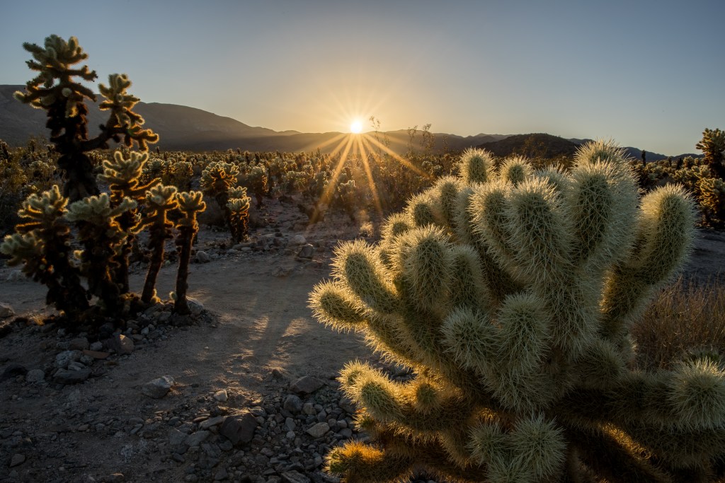
With at least 17 species of flowering plants and cacti along the route, this stroll through the Cholla Cactus Garden is the perfect place to learn about the local flora and fauna. Just be sure to stick to the trail—it’s namesake cacti, nicknamed teddybear cholla, may look fuzzy, but their spines will stick in your skin if you happen to brush against them. Try to plan your visit for April or May when much of the vegetation, such as desert sage, starvine, brittlebrush and chollas, should be in bloom.

Setting sun at Cholla Cactus Garden (Photo Credit: NPS/Glauco Puig-Santana)
Barker Dam Nature Trail
- Location: 23 miles southwest of Twentynine Palms, CA
- Length: 1.3-mile lollipop
- Difficulty Rating: Easy
- Best For: A short historical hike to a man-made oasis
- Dogs: No Dogs
Easy and well-marked, this trail takes you out to Barker Dam, which was built in 1900 and forms a small, man-made oasis that nourishes the native wildlife. Evening is your best chance to spot these locals as they often emerge for a drink after the tourist crowds have mostly gone. The dam isn’t the only piece of history on this hike—the ruins of a few buildings and an old cattle trough can be spotted near the dam and petroglyphs can be found down a short side trail as you loop back to the trailhead. Keep in mind, the trailhead is often congested during the peak seasons of spring and autumn.
Cap Rock Nature Trail
- Location: 20.1 miles southwest of Twentynine Palms, CA
- Length: 0.4-mile loop
- Difficulty Rating: Easy/Intermediate
- Best For: A picnic and a stroll
- Dogs: No Dogs
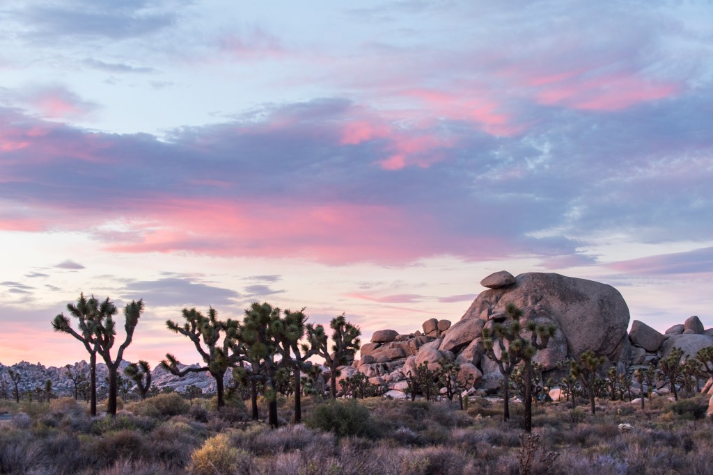
This trail may be short, but take your time getting to know it. The Joshua trees, twisted and bent against the rocky desert backdrop, look like something out of a Dr. Seuss book. In the spring, abundant wildflowers and cacti bloom along the trail, adding color to the stark landscape. The trail circles the main rock outcrop; as you walk, admire the precariously-balanced Cap Rock, perched on top of the main outcrop. The unique geologic feature is a result of millennia of erosion by wind and water. After your hike, either snag one of the picnic tables at the parking lot or find a shady spot along the trail to enjoy a picnic. Or get vertical instead, as the outcrop is also a popular climbing crag.

Cap Rock in the setting sun (Photo Credit: NPS/Brad Sutton)
Hidden Valley Nature Trail
- Location: 21.9 miles southwest of Twentynine Palms, CA
- Length: 1-mile loop
- Difficulty Rating: Easy/Intermediate
- Best For: An excursion through a unique environment
- Dogs: No Dogs
The tall and narrow rock walls of Hidden Valley form a natural corral that features a unique microclimate home to cacti, lizards, amphibians, birds and other critters not often found elsewhere in the park. You’ll learn all about them as you stop to read the informational signs that line the level, hard-packed sand trail. It’s rumored that cattle rustlers once used the valley as a hideout, and, in 1936, desert homesteader Bill Keys started using this valley to protect his cattle as they grazed.
Ryan Mountain Trail
- Location: 17.8 miles southwest of Twentynine Palms, CA
- Length: 2.9-mile out-and-back
- Difficulty Rating: Intermediate
- Best For: Bang for your buck
- Dogs: No dogs
It’s just 1.5 miles to the top of Ryan Mountain, but you’ll gain just over 1,000 feet of elevation along the way. While the sun may be hot, as there is no shade, there’s nothing to impede the views, which only get better as you climb. Your efforts are rewarded at the summit with an endless panorama of the park, Lost Horse Valley, Pinto Basin and Pleasant Valley. For a unique experience, stay to enjoy the sunset, just remember to bring a headlamp for the hike out.
Fortynine Palms Oasis Trail
- Location: 5.7 miles west of Twentynine Palms, CA
- Length: 3.1 mile out-and-back
- Difficulty Rating: Intermediate
- Best For: A sunny hike to a secluded oasis
- Dogs: No dogs
Fortynine Palms Oasis is a great place to escape the sun, just don’t expect much shade along the hike in. What begins as a sand and gravel trail with a few sets of stairs eventually becomes rugged and rocky. It’s not recommended to attempt the trek in the summer, and you’ll want to pack sun protection and plenty of water the rest of the year. Once you reach the oasis, you’ll be greeted by two stands of palm trees in a rocky canyon. The first stand is a wonderful place to explore, rest and enjoy some shade, but the park asks visitors to steer clear of the second to protect its fragile habitat.
Warren Peak Out-and-Back
- Location: 5.1 miles southeast of Yucca Valley, CA
- Length: 5.8-mile out-and-back
- Difficulty Rating: Intermediate
- Best For: A summit hike that starts on the edge of town
- Dogs: No Dogs
Easy to access from the town of Yucca Valley, this route is a straightforward way to nab some views without the long drive into the park. Just follow the signs that say WP (Warren Peak) through each intersection until you get to the summit where views of the surrounding peaks, Palm Springs, Big Bear and San Jacinta await. The return trip can be as simple as heading back the same way, but if you’re eager for a few more miles, some canyon hiking and additional views, hop on the popular Panorama Loop (signs for PL); just be sure you brought enough water for the additional mileage.
Lost Horse Mine Loop
- Location: 23.3 miles southwest of Twentynine Palms, CA
- Length: 6.4-mile loop
- Difficulty Rating: Intermediate
- Best For: A hearty hike through an iconic Joshua Tree landscape to an old gold mine
- Dogs: No dogs
Prior to the park’s designation as a national monument in 1936, there were around 300 mines in this area starting in the 1800s, though few of them were profitable. One exception was the Lost Horse Mine, which produced about $5 million in gold and silver between 1894 and 1931. Along the hike, you can view the stamp mill, where the gold ore was crushed, still standing at the mine site, but a chain link fence surrounds the dangerous open mine shafts. After exploring the area, head up Lost Horse Mountain to enjoy views of the park. The return leg of the loop passes the unproductive Optimist Mine, which is marked by the remains of a stone chimney.
Lost Palms Oasis
- Location: 33.4 miles east of Indio, CA
- Length: 7.3-mile out-and-back
- Difficulty Rating: Intermediate
- Best For: A rugged hike to a large palm stand
- Dogs: No dogs
Despite their intermediate ratings and similar names, the out-and-back trek to Lost Palms Oasis is a much tougher undertaking than the hike to Fortynine Palms due to its longer mileage and the extensive sun exposure. However, it’s an outstanding opportunity to visit two of the park’s oases in one shot. You’ll start in a small but beautiful grove of palms at Cottonwood Spring Oasis—desert shrub, spring wildflowers, lizards, bees and the rare goat occupy the wash here—before climbing through the exposed scrub desert. You’ll navigate boulders, gullies and rocky trail as you near the end. There’s a spur trail that overlooks the oasis, but don’t linger too long, as your destination awaits. Lost Palms, the largest stand of palms in the park, is a wonderfully shady spot to have a picnic and cool off.
