Our first trek in New Zealand literally ended in disaster. We noticed the clouds building as we started to hike the popular Abel Tasman Coast Track, but nothing in the forecast indicated what was about to unleash on us.
The rain and wind began after dark, flooding our camp by morning. Something didn’t feel right. I mean, this was supposed to be the scenic cruise of golden sand beaches and swimming in crystal clear water. Instead we were smack in the middle of some of the heaviest weather we’ve ever experienced in the backcountry. And that’s saying a lot: We live, work and play in Coastal Alaska.
We decided the storm was not going to abate any time soon, so we made a run for it. One could hardly walk when exposed to the hurricane force winds in the track’s open sections. We sloshed through shin-deep standing water once back in the trees.
The rains continued back in the harbor town of Nelson where we stood in the checkout line at the market, still dripping wet and feeling burned by our lack of weather karma. The daily newspaper on display announced that director Peter Jackson had to pull his team out of the hills and postpone filming of “The Hobbit” due to the storm. That put things in perspective. So did seeing the flooded parking lot when we exited the market.
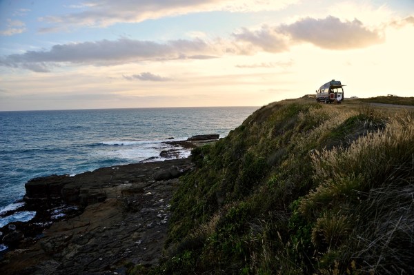
Van camping is all about the spot. Parked for the night overlooking Curio and Porpoise bays in the Catlins on the South Island of New Zealand.
We packed away our groceries in “Lucky,” our rental van, filled it with gas and hit the road. That storm raged on for three more days, causing huge floods and landslides around Nelson. We motored for days until we finally escaped the rain in Queenstown, on the lee side of the Southern Alps. The first newspaper we saw related that several sections of the Abel Tasman Coast Track had been washed away and dozens of hikers had to be rescued by boat in very rough conditions. Our perspective had come full circle. We were lucky.
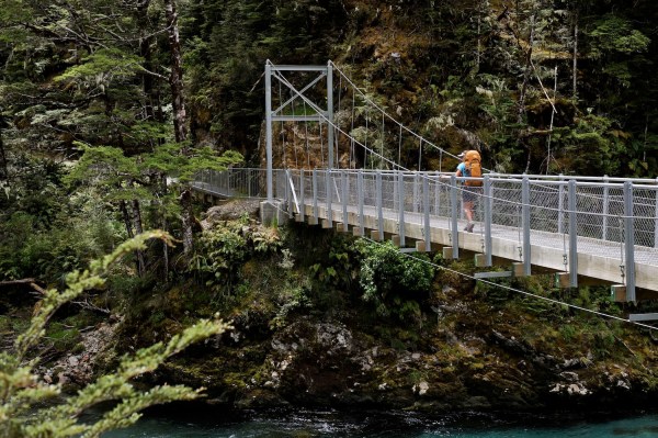
The 32-km Routeburn Track starts with a bridge crossing over its namesake river.
We were also done with the coast and ready to dive into the rugged mountains of the famed Southern Alps. After a brief stint of drying out and preparing food and gear in Queenstown, we struck out for the famed Routeburn Track in Mount Aspiring National Park. The 32-kilometer Routeburn (“burn” is Scots Gaelic for river) might be the most popular of all nine of New Zealand’s Great Walks, providing sturdy bridges, well-maintained trail, and huts so clean you can extend the five-second drop rule in the cook area to a full minute.
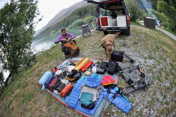
Packing up on the banks of Lake Wakatipu in preparation for a trek along the Routeburn Track in Mount Aspiring National Park.
We were fortunate to get a permit for the trek, and even though we’re not used to being so well taken care of on a hike, we were stoked to be in the mountains. Plus, after our recent spanking on the “beach cruise,” we were happy to pull back a bit on the throttle and simply enjoy not drowning on the trail. The lush beech forests and turquoise rivers were like nothing we’d ever seen.
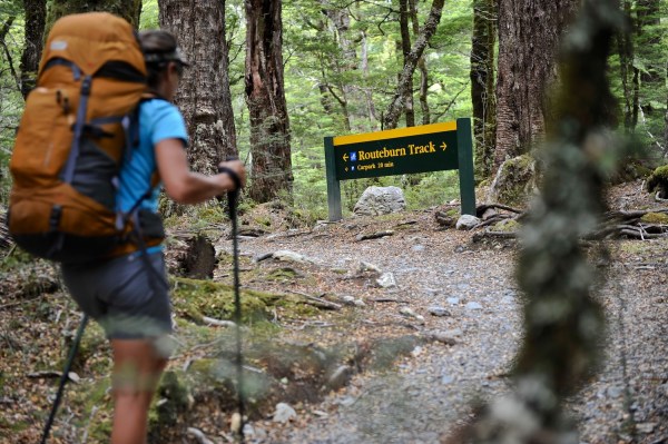
One of New Zealand’s Great Walks, the Routeburn Track is very well marked and maintained in its entirety by the Department of Conservation.
We lingered for an entire day up in Harris Saddle, the Routeburn’s high point, and spent Christmas camped at Lake Mackenzie with a motley crew of travelers from around the world. The walk went by so easily that we decided to head up over McKellar Saddle to the Caples Track and close the loop back to our van. Set up for the night on Lake Wakatipu, we toasted a stress-free trip well done.
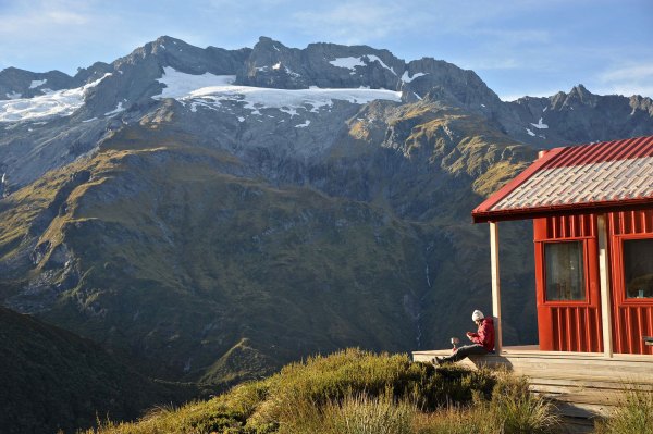
Enjoying an afternoon brew on the steps of the Liverpool Hut overlooking Rob Roy Peak, Mount Aspiring National Park.
Even though the Routeburn was the perfect intro trek in New Zealand, we craved more of an adventure. Something with more uncertainty, or at least the chance of getting off-route. Looking at the jagged peaks around us, we were sure we could find a suitable challenge. With only time for one more trek, we left the South Island still craving that spice of mountain life.
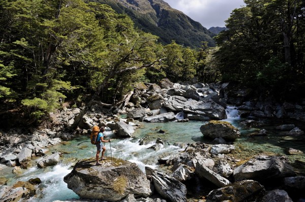
Crossing a tributary creek on the world famous Routeburn Track. The trek tours some gorgeous waters.
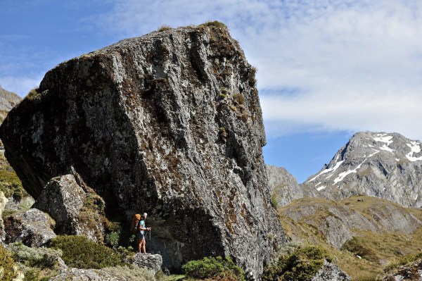
Passing underneath a huge erratic on the way to Lake Harris; Routeburn Track, Mount Aspiring National Park.
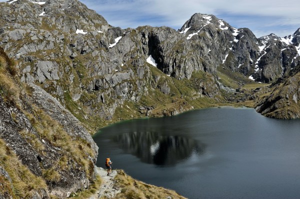
Walking high above Lake Harris was a highlight of the Routeburn Track in Mount Aspiring National Park.
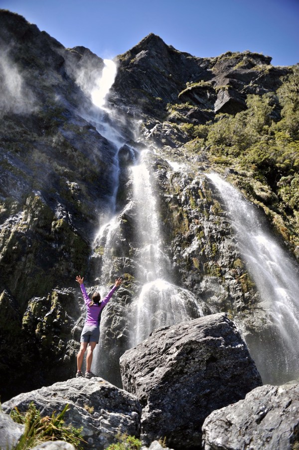
Earland Falls cascades 174 meters down to the Routeburn Track in Mount Aspiring National Park.
Fast forward three years: We’re back on the South Island to find what was rumored to be the country’s most spectacular hut. Originally built to host scientific teams interested in the region’s glaciers and geology, the Ivory Lake Hut is now relegated to sheltering backpackers in the Lange Range. Not too many trampers (Kiwi speak for hikers or trekkers) actually make it into this alpine shack: Records showed less than a dozen annually.
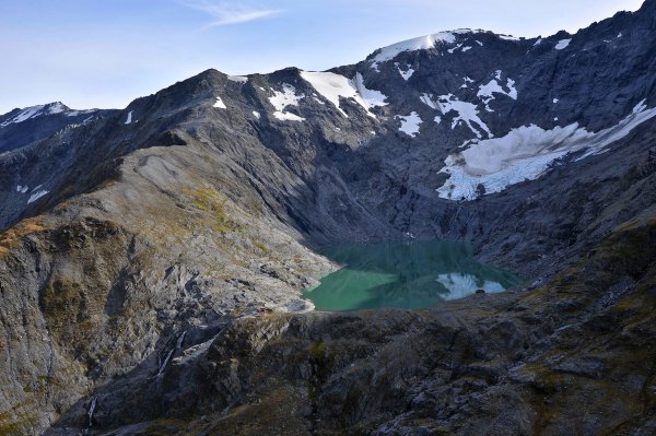
Ivory Lake Hut on the lip of Ivory Lake cirque, at the head of remote Waitaha Valley. Reaching the hut is a difficult challenge since portions of the valley track are no longer maintained. View from Park Dome.
The hut is buried deep in the heart of the Southern Alps and whichever route you choose is arduous even by New Zealand standards. The tracks into these valleys have all been washed away or reclaimed by the forests. The word “gnarly” kept rearing its head in conversations and email threads as we prepared for this adventure. The whole thing sounded perfect to us. The type of work we excel at. And besides, it’s still a backpacking project. How gnarly could it get?
Soon after leaving Christchurch we’re clinging in trepidation to one of the most crumbly, exposed ridgelines we’ve ever been on without climbing gear. Our new Kiwi friend, Andrew Buglass, who met up with us for this adventure at the start in Hokitika, moves over this crux section of Dickie Ridge with ease.
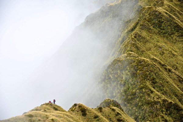
Dickie Ridge soars into clouds above Dickie Spur Hut. A narrow spine known for exposure and crumbly schist, Dickie Ridge is one of the most feared “tramps” in New Zealand. Negotiating this 3-km section is slow going with a lot of scrambling.
He waits patiently and offers encouragement as we negotiate the fifth-class terrain, trying to pull on the tufts of grass that seem sturdier than the face of friable shale. We’re clad in hiking boots and have trekking poles to help in schlepping our 60-pound packs through this mountain wilderness. That morning, our second day of the trek, we had decided to take the high route. Little did we know what we were getting ourselves into. Rock crumbles off the face with every move and tumbles through 500 meters of air beneath our boots. A mist moves in, reducing visibility to less than a meter. As the Kiwis would say, we were in a bit of a spot.
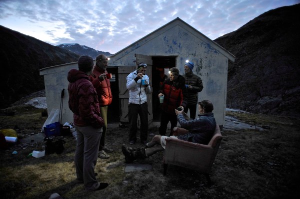
Dinnertime at Ivory Lake Hut with the locals. Our last night here we were joined by a half-dozen Kiwi trampers from all over New Zealand. A real treat and surprise, since the annual visitor count to this hut is only about a dozen people.
It was a day after negotiating Dickie Ridge that we arrived at the head of the Waitaha River Valley. Water cascaded wildly from every side of the rocky cirque. The water came from Ivory Lake, which was on a glacier-carved bench above us. No one dared to speak, but we knew we had made it. An hour later, we picked our way through the rocks and walked up to the namesake hut. Andrew promptly brought out a ragged red armchair from inside. The pint of bourbon also came out as we basked in the afternoon sun, soaking in this hard-earned place in the mountains. We stayed for a couple nights before taking a different route back to Hokitika where we parted ways. A week later in a different part of the Southern Alps, in a hut much easier to access, we came across the March issue of Wilderness, a Kiwi backpacking journal. The cover boasted a feature on the top ten most “exciting” hikes in New Zealand. There was Dickie Ridge claiming the number one spot.
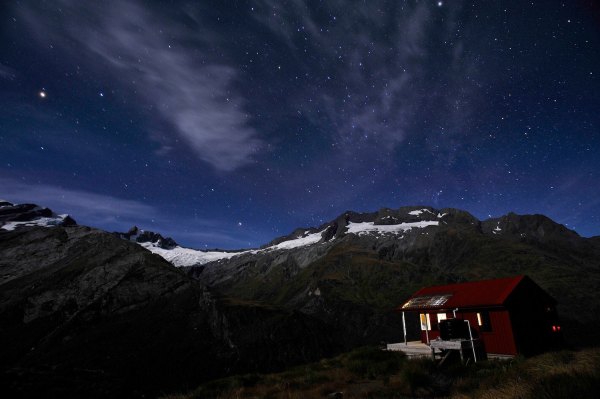
A starry night over Rob Roy Peak and the Liverpool Hut, Mount Aspiring National Park.
We had finally found the adventure we were looking for.
