Comparing culture, gear, resupply and difficulty.
Whether you’re deciding which footpath to tackle for a first thru-hike, you’ve hiked one trail and want to know how it stacks up to the other, or you just have a general curiosity, a fascination with comparing the Appalachian Trail (AT) and Pacific Crest Trail (PCT) is common.
Today, as someone who’s hiked both the AT (2011) and PCT (2017), I am in an esteemed club and can speak to their differences firsthand. This is how they stack up.*
Trail Culture
Perhaps it goes without saying, but trail culture differs on the AT and PCT. There are many reasons for this, but likely the biggest is that the AT has historically attracted more hikers, rendering it a more social trail. However, as a result of the added attention the popular novel and movie Wild the brought to the PCT, as well as the growing popularity of thru-hiking, the gap between the two trails seems to be closing. Here are a few of the key remaining differences.
Backpacking experience: Those attempting the AT are far more likely to be on their first long-distance backpacking trip compared to those taking on the PCT. In fact in 2017, only 3.2 percent of AT hikers had been on a three-or-more-month backpacking trip prior to embarking, whereas a third of PCT hikers had already hiked the AT. As a result, the “first day of camp” effect can be more prevalent on the AT, whereas PCT hikers are likely seeing the trail for the first time, but not necessarily experiencing their first long trek.
Common meeting points: One unique aspect of hiking the AT is the prevalence of shelters. There are over 250 in total, or one, on average, every eight miles. Many hikers choose to make shelters their home for the night, whether they actually sleep inside the three-walled structure or camp nearby. They’re also popular break points during the day for the purpose of grabbing a snack, signing the register or collecting water. Much of the trail camaraderie originates here.
On the PCT, common meeting points do exist, such as streams and campsites, but because they exist in greater numbers and often don’t make for the best place to break, groups are less likely to form. Overall, you’re less likely to run into other hikers during a break or at night on the PCT.

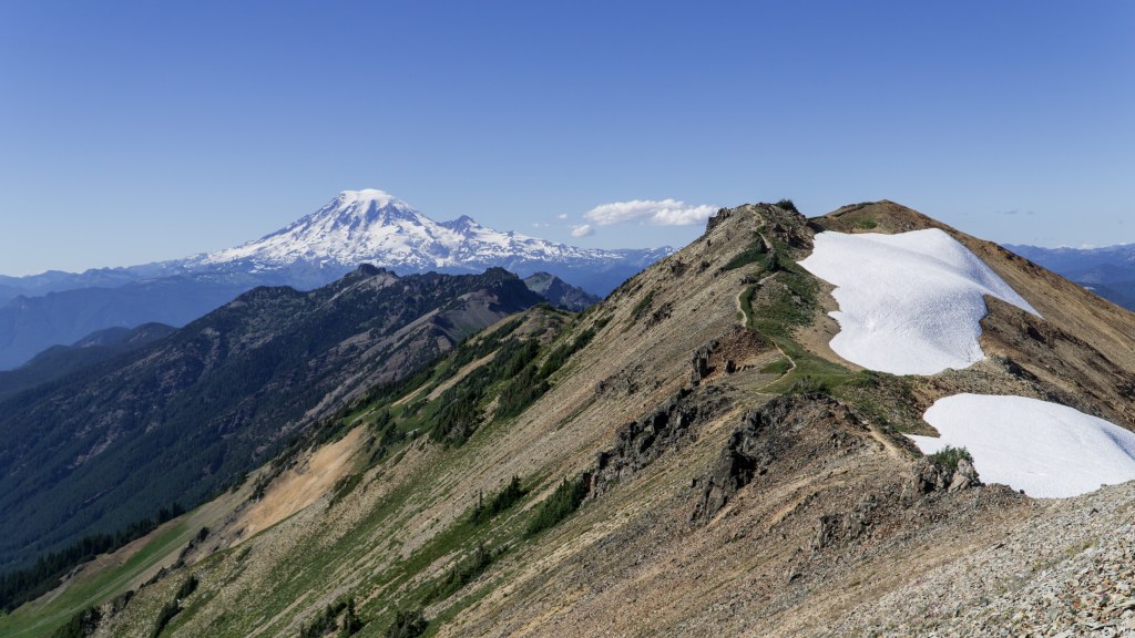
The Pacific Crest Trail in Washington. Photo courtesy of Zach Davis.
Town infrastructure: On the AT, towns are generally closer to the trail and have catered to greater numbers of hikers over the years. As a result, AT trail towns are often more accustomed to the influx of “hiker trash” (the term thru-hikers lovingly use to refer to one another), and better cater to their needs. The most obvious example of this is the prevalence of hostels, which make excellent gathering spots for hikers.
Because hostels are a rarity in PCT towns, motels are the most common off-trail form of lodging for its hikers. Popular trail angels exist in a handful of towns along the PCT, who will provide similar services to a hostel, although it’s much less common and they can accommodate fewer hikers. Wait times for a hitchhike, the primary mode of transport from trail to town and back, are often much shorter on the AT compared to the PCT.
Shared definition of a thru-hike: On the AT, hikers seem to adopt a more purist definition of a thru-hike, which is to hike each and every mile of the trail. On the PCT, because of the probability of wildfires and high snow years, trail closures are all but guaranteed. For this reason, the ability to hike every mile of the trail is out of one’s control. The exact definition is an ongoing (and pointless) debate, but as a general rule of thumb, it’s less concrete on the PCT.

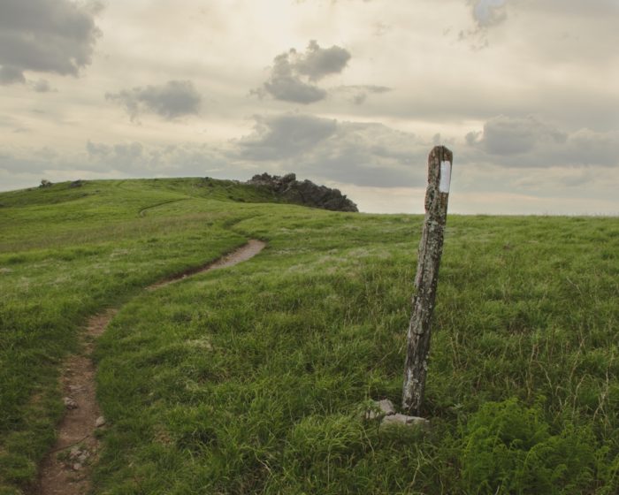
The Appalachian Trail in Virginia. Photo courtesy of Koty Sapp.
Gear
Gear needs between the AT and PCT are more similar than dissimilar. The biggest difference is how one’s getup evolves along the trail. Although needs vary by season on the AT, on the PCT they’re dictated largely by segment.
Segment versus season: The PCT is divided into five segments: Southern California (or “the desert”), Central California (or “the Sierra”), Northern California, Oregon and Washington. Gear needs can vary dramatically between them. For instance, in the desert, northbound (NOBO) hikers will likely encounter days with triple-digit temperatures, constant sun exposure and 20 miles between water sources. A week later, once reaching the Sierra, they’re walking atop several feet of snow at 12,000 feet.
The desert can get punishingly hot—as high as 110—or freezing cold—often 30 or below. Many hikers will bring a sun-protective shirt, hat, pants and gloves; a sun umbrella (optional); a sleep system suitable for at least 20 degrees; and the ability to carry up to 7 liters of water. For the Sierra, in an average to above average snow year, hikers will need an ice axe and snow traction, most commonly MICROspikes. Additionally, hikers are required to carry a bear canister through this section, which may also result in the need for a larger pack. In Northern California, a hiker’s gear will resemble their desert setup, with the biggest difference being the addition of mosquito repellent and/or clothing (including a head net).
For Oregon, I recommend a smartphone loaded with several podcasts and/or audiobooks (hikers often cite this flat, heavily forested section as the most boring). Lastly, in Washington hikers need cold-weather gear plus a rain jacket, pants and gloves for its notorious rainy season.
On the AT, the season often dictates gear needs. Many falsely assume the southern Appalachians are warm in the heart of the spring. These hikers will be in for a rude awakening. The odds of avoiding a snowstorm in the first few hundred miles of the trail are not in your favor. Cold weather gear is essential through at least the Grayson Highlands (Southern Virginia), although I typically recommend hikers hold onto their warmer layers and sleeping bag until Daleville (Central Virginia). Thru-hikers can get by with their warm-weather gear from this point all the way through the Mid-Atlantic states. Hikers typically recoup their cold-weather gear at Glencliff, New Hampshire, the section just before entering into White Mountain National Forest.

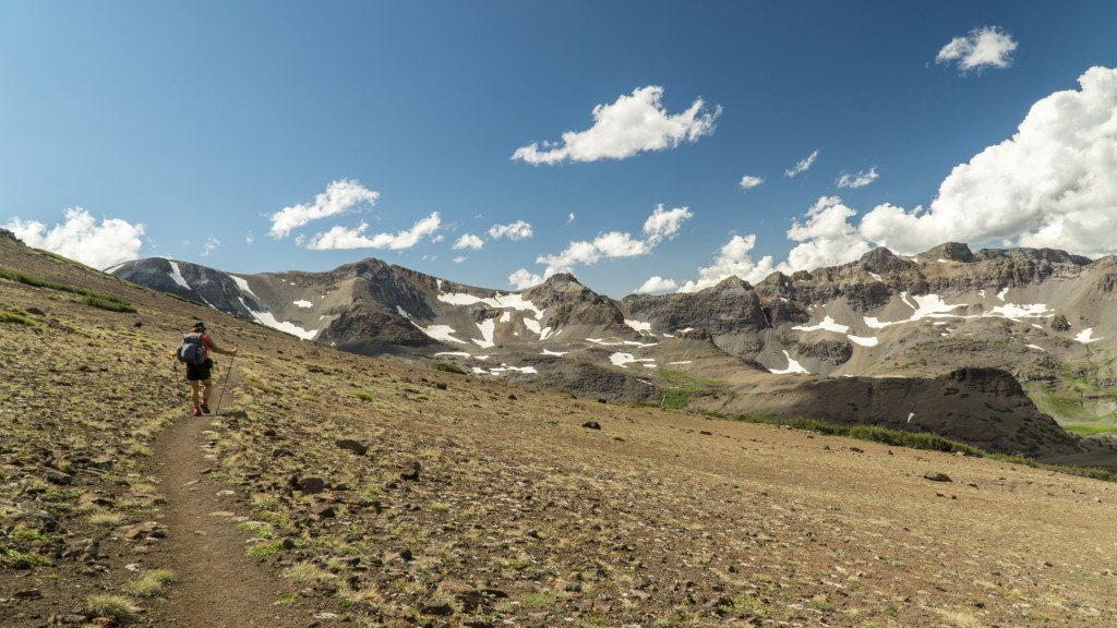
Pacific Crest Trail in The Sierra. Photo courtesy of Zach Davis.
Humidity: The AT is much more humid than the PCT, and consequently, the daily temperature swings are milder. You can experience bone-chilling nights anywhere on the PCT, even if battling blistering heat during the afternoon. On the AT, you’re all but guaranteed several sweaty sleeps during the summer months. For this reason, AT hikers can swap out their cold-weather sleeping bag for something lighter during the middle section of the trail (see above). PCT hikers are advised to hold onto their 20-degree (add or subtract insulation based on your metabolic needs) bag or quilt for the duration of the trail.
Head here to learn how to pack for the AT and here for the PCT.
Resupply
There are two methods for procuring food on a thru-hike: mail drops and resupplying. The former requires mailing yourself food (or soliciting the help of a loved one) in advance of reaching your destination. The latter is as simple as purchasing your grub from a grocery or convenience store when in town. Best practices for either trail use a combination of the two, although at a very different ratio. For instance, one could potentially hike the entirety of the AT without sending a single mail drop. While this strategy could be implemented on the PCT, it’s certainly not advisable.
The key similarity between resupplying on the AT and PCT is that decent food options exist at nearly every town, resort and ranch on both trails. Assuming you’re willing to subsist off instant mashed potatoes, ramen, peanut butter, candy bars and trail mix from one town to the next, the ability to fill your food bag with hiker-friendly fare is nearly ubiquitous.

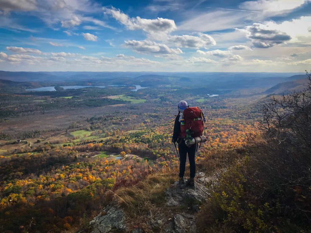
The Appalachian Trail in New Hampshire. Photo courtesy of Koty Sapp.
The primary difference is that the cost of resupply in many spots on the PCT is astronomical. Several resupply destinations on the PCT are remote and hotbeds for tourism and captive adventurists. For this reason, anyone hiking on a budget would be better served sending mail drops to many locations on trail. The sections where resupply are most beneficial are through most of the Sierra, much of Oregon and all of Washington. If you want to learn more about resupplying on the PCT, this resource will satisfy your curiosity. Resupplying on the AT is much more straightforward; however, there are still a handful of locations where a mail drop will likely save you money.
Difficulty
“Is the AT or PCT more difficult?” is the question I get more than any other from those wanting to know the difference between the trails. In short, the answer will vary depending on your personal experiences.
You’ll want to note that the AT takes five to seven months to complete its 2,190 miles, while the PCT take four to six months to complete 2,650 miles of trail. That shows, when evaluating the most obvious factor, terrain, the AT is without question the more difficult of the two trails. Not only is the PCT graded much more favorably than the AT, you’ll find a much more rugged tread with more rocks and roots on the AT. These factors result in a slower pace on the AT with more energy exerted in a given day.
That said, despite the easier terrain, the PCT could be perceived as the more challenging trail to some. For instance, if a denser grouping of hikers is appealing to your style of hiking or if high elevation, constant heat and sun exposure or steep slopes are elements you’re ill-equipped to handle, the AT may be the easier choice for you.
It’s true that most people who’ve hiked both trails will crown the AT as the more difficult trail. I too am in this group. But this analysis is far from unanimous.
The preceding comparison is merely the tip of the iceberg when evaluating the United States’ two most popular long trails. If your curiosity stretches beyond this article, you will find a much more satisfying education on the trails themselves. See you out there!
*The above are only generalities. Hikers’ needs and experiences will vary wildly.
All photos courtesy of Zach Davis and Koty Sapp.
