Thousands of feet below the rim, the mighty Colorado River hints at the forces that created the Grand Canyon, an unprecedented confluence of rock, water and time. But the river is far from the only water feature found within the 277-mile-long chasm, and those who venture down the canyon’s walls, along its intricate network of trails, are often rewarded with views of some of the national park’s most alluring features: its waterfalls.
But beware. The canyon’s steep walls mean reaching these often hidden oases is demanding, and summer brings temperatures of over 100 degrees at the canyon bottom. Winter snows can also close the North Rim, so plan these hikes for May and early June or September through October. No matter the season, accessing these eight cascades requires traveling through 1.8 billion years of geological time and witnessing the life source of this place, the untamed water that spills over—and sometimes through—the canyon walls from tributary creeks, underground rivers, unknown springs and secluded caves.
Deer Creek Falls
- Location: North Rim
- Length: 20.4 miles round-trip
- Difficulty: Intermediate
- Best for: Overnight backpackers
- Dogs: No dogs
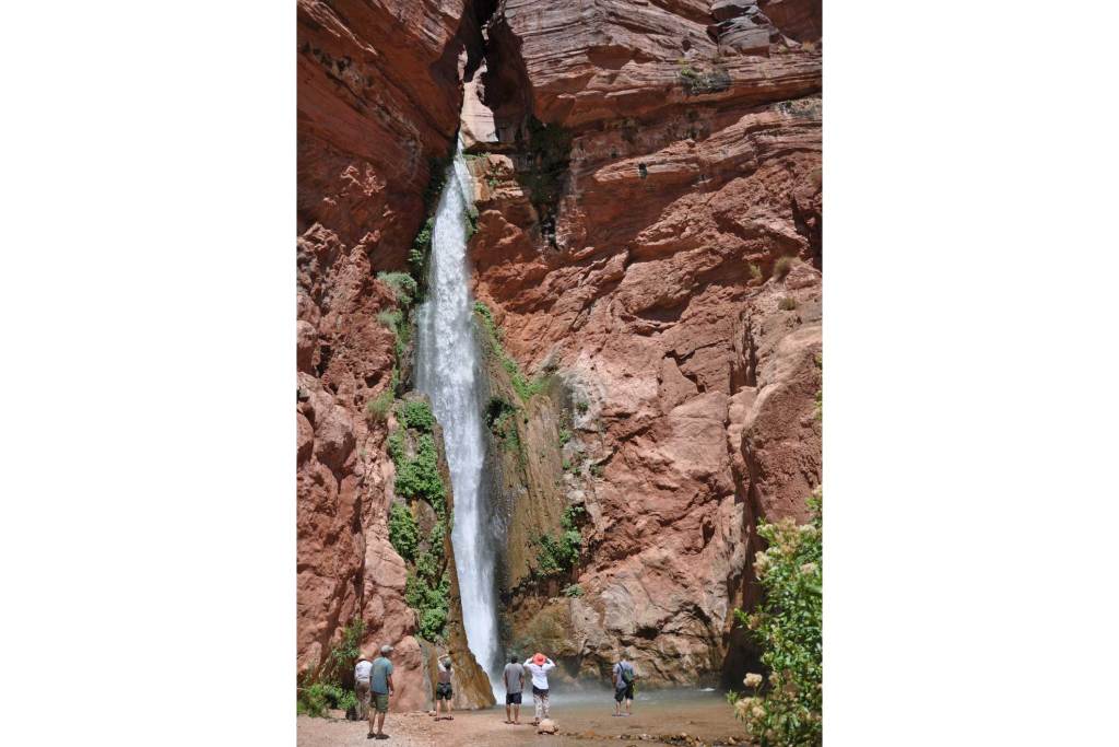
Tucked into a remote pocket below the Grand Canyon’s North Rim, spring-fed Deer Creek free-falls 180 feet into the Colorado River in a single plunge. To get there, head to Monument Point from the Bill Hall trailhead, which though more challenging, will save you 2.5 miles compared to the older Thunder River trailhead. In a few miles, at the Esplanade, you’ll join the Thunder River Trail. Continue down into the sun-drenched Surprise Valley, keeping an eye out for the cairns marking the route, especially the large one that marks the right turn onto Deer Creek Trail, which leads to the falls. Don’t miss it, or you’ll end up at the wrong waterfall. Continue past the cooling waters of Deer Spring to a rock ledge known as The Patio to take in incredible views of The Narrows, a slot canyon which is now closed to hiking, climbing and canyoneering to protect it from damage. The final stretch descends a steep set of switchbacks. Soak in the pool at the base of the cascade to cool off. You’ll have earned it.

Thunder Falls
- Location: North Rim
- Total length: 25 miles round-trip
- Difficulty: Intermediate/difficult
- Best for: Backpackers with basic canyoneering experience
- Dogs: No dogs
The Thunder River flows underground before unleashing its torrent through a cave mouth high up the canyon’s Muav Limestone cliffs. Though its source remains a mystery, cave explorer Steve Eginoire, who has spent extensive time mapping these underground waterways, theorizes the North Rim’s porous rock funnels snowmelt and rain to replenish underground springs.
A trip to study the falls yourself usually takes three days and begins as a relatively flat slickrock stroll along the Esplanade via the Thunder River Trail or Bill Hall Trail, then abruptly shifts to a steep switchback descent through the colorful Supai and Redwall formations to the floor of Surprise Valley. Stay left where the trail splits as the right fork leads to Deer Creek Falls. The route then flattens for about a mile. Take advantage of the brief respite before drawing on your canyoneering experience to safely reach Thunder Falls: There’s an eight-foot down-climb where you may opt to use a rope to lower your packs. After tumbling down the steep canyon wall, the Thunder River runs above ground for just half a mile before joining Tapeats Creek.
Keep in mind, temperatures in the south-facing Surprise Valley can be dangerously high. Hiking here after 10am or before 4pm during warmer months is not recommended.
Elves Chasm
- Location: South Rim
- Total length: 29 miles round-trip
- Difficulty: Difficult
- Best for: Fit canyoneers with strong technical and rappelling skills
- Dogs: No dogs
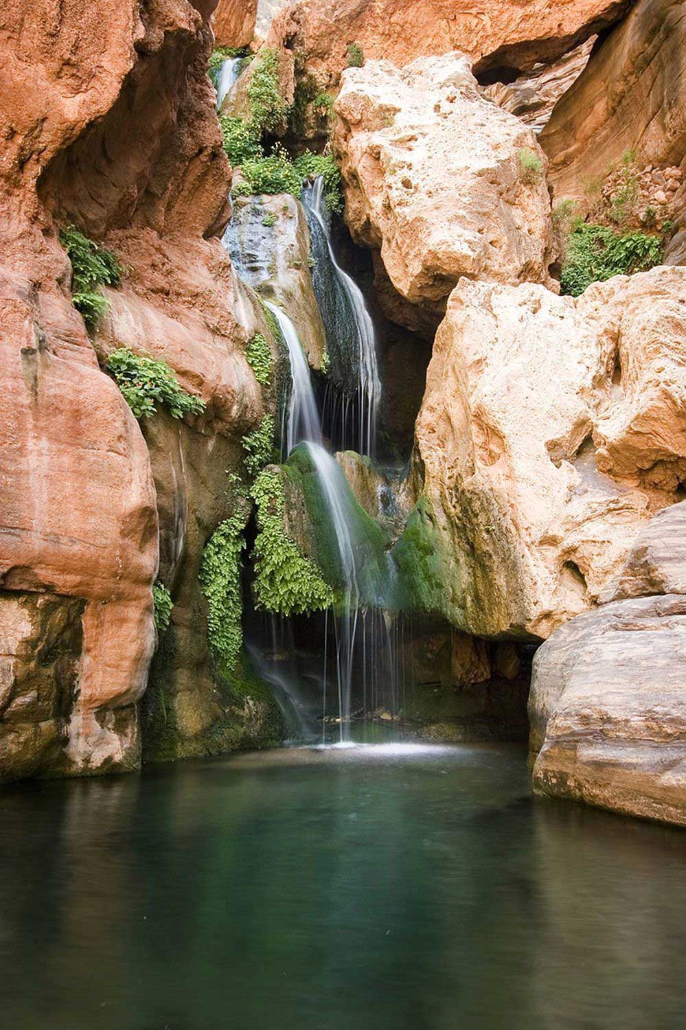
Swimming in the pools carved by this waterfall is a worthy reward for the scrambling, slithering, hopping and rappelling it takes to reach the secluded oasis. The route begins at the South Bass trailhead, located on the South Rim approximately 25 miles west of the Grand Canyon Village, before turning left off that trail onto the Royal Arch Route. A 20-foot rappel is required, so this hike is only suitable for those with technical canyoneering and rappelling experience. If you’re not sure that’s you, you shouldn’t attempt it. The final section along the river via Elves Chasm Trail follows rough terrain. Expect plenty of boulder hopping and bushwacking to reach the grotto which houses the falls.

Ribbon Falls
- Location: North Rim
- Total length: 24.7 miles round-trip
- Difficulty: Intermediate/difficult
- Best for: Strong day hikers and overnight backpackers
- Dogs: No dogs
Although it’s easier to reach this 100-foot-tall cascade along a 16.4-mile round-trip route from the North Rim, the approach from the South Rim is open all year and has more amenities near the trailhead for road-weary travelers. The route starts just east of Grand Canyon Village, home to the park’s iconic El Tovar Hotel and plenty of services, at the South Kaibab Trail before switching to the Ribbon Falls Trail for the final push. Keep in mind that the trailhead is closed to private vehicles, so you’ll need to plan to take the NPS Shuttle System.
At almost 14 miles one-way, it’s worth taking two days to backpack the route, but be sure to obtain a backcountry permit from the Park Service and check the camping and backcountry travel regulations. But whether you’re camping or making a very long day of it, be sure to swim in the pool below the falls and hike around to the backside of the torrent for a view straight down the side canyon through the cascade.
(Editor’s note: As of July 1, 2019, the Ribbon Falls Bridge remains closed after sustaining damage in April, and access to the falls is restricted until further notice. Check with the National Parks Service for updates and other trail closures in the park.)
Havasupai Indian Reservation
- Location: Havasupai Indian Reservation
- Total length: 20.6 miles round-trip
- Difficulty: Intermediate/Difficult
- Best for: Average hikers hikers and families with older children
- Dogs: No dogs
Havasupai means “people of the blue green water,” and the residents of the Havasupai Indian Reservation consider these spectacular, colorful falls their life source. Thus, it’s imperative that hikers visiting the area treat it with respect and use ethical hiking practices to honor the landscape’s sacred heritage, modern inhabitants and surrounding wilderness.
And while you’ve no doubt seen stunning photos of the reservation’s sparkling waterfalls all over the internet, access is restricted to protect it from being over-impacted and spoiled. Permits can be obtained directly through the Havasupai Tribe and typically close in February. Apply as soon as possible as they’re often gone shortly after becoming available.
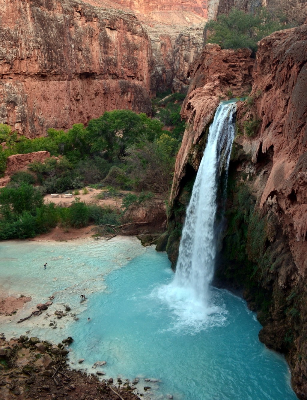
But trust us. The paperwork is worth it. In addition to the watercolor-painted cascade, travertine dams create natural infinity pools below each falls. The first 10.5 miles along Havasu Canyon Trail from Hualapai Hilltop to Havasupai Campground (where you’ll need to stop and check in at the ranger station) alternate between stretches of relatively flat or downhill non-technical terrain. You’ll pass Havasu and Little Navajo Falls, then the trail steepens dramatically, descending ladders and chains to reach finally reaching the 200-foot-tall Mooney Falls.

Havasu Falls is just one of the many iconic water features found in the Havasupai Indian Reservation.
Cheyava Falls
- Location: North Rim
- Total length: 43.4 round-trip
- Difficulty: Intermediate/difficult
- Best for: Serious backpackers
- Dogs: No dogs
The stunning 800-foot Cheyava Falls only flows when snow is melting or after significant rainfall. In fact, Cheyava is a Hopi word meaning “intermittent waters.” With that in mind, you’ll want to plan this hike for late spring when runoff is at its highest. And though the 43-mile round-trip requires a minimum of three to four days for even hearty hikers, the greatest challenge may be obtaining a permit, as it is necessary to apply four months before your proposed start date with no guarantee of acceptance.
While the falls sit within the North Rim, the South Rim’s popular South Kaibab Trail is the shortest approach. After crossing the Colorado River at famed Phantom Ranch 6.5 miles in, you’ll join the North Kaibab Trail for a mile to reach the junction with Clear Creek Trail. This entire south-facing stretch is exposed, notoriously hot and devoid of water sources. Plan to hike in the morning and evening hours with ample water. From the end of the trail, you must hike an additional 5 miles upstream along the creek to reach the falls. This is an off-trail route and will be challenging, but it the water is flowing, you’ll be treated to the tallest waterfall in the Grand Canyon.
Vasey’s Paradise
- Location: North Rim
- Total length: 13 miles round-trip
- Difficulty: Difficult
- Best for: Experienced and fit canyon hikers
- Dogs: No dogs
Arriving at Vasey’s Paradise always comes with a cost, and the demanding waterless approach via the South Canyon Trail is no exception. The trail is a steep scramble marked only by a series of faint cairns so hikers should be well versed in route finding and navigating technical terrain. This classic and unrelenting desert trek requires frequent bushwacking and switchback descents. Save your energy for the final 12-foot dryfall downclimb near the dueling falls that spill from groundwater springs and fuel this lush oasis.
This local guide is presented by Teva. Teva was born in the Grand Canyon back in 1984, when a river guide rigged two Velcro watchbands to an old pair of flip flops and created a shoe that wouldn’t float away. This year, Teva is celebrating its roots and the 100th anniversary of the Grand Canyon National Park with its GC100 Collection.
