The big question right now for outdoor enthusiasts in the western U.S. is how much snow will fall this winter.
Last year was a mixed bag, with snow drought conditions in California and southern Utah, while Washington, Idaho and Montana made up for a dry fall to end up with above-normal snowpack by early spring.
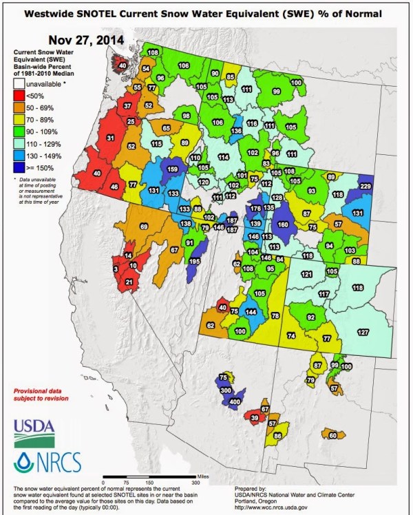
The latest snowpack information from the USDA Snotel network indicates well-below-normal snowpack over the Sierra and Cascades, but near-normal conditions over Colorado, Wyoming, Montana and Idaho.

But what will happen next? Meteorologists’ most useful tool for predicting the nature of western U.S. winters is the correlation between El Nino/La Nina and regional weather. El Nino years are associated with warmer-than-normal tropical Pacific waters and often bring warmer-than-normal conditions to the western U.S., less snow in the northwest and more precipitation in the southwest.
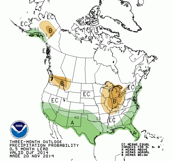
It appears this winter we will be in a weak El Nino pattern, and forecasters at the National Weather Service’s Climate Prediction Center are predicting a winter with El Nino characteristics. There will be more precipitation over the southern tier of of the U.S. and drier-than-normal conditions over the Northwest.

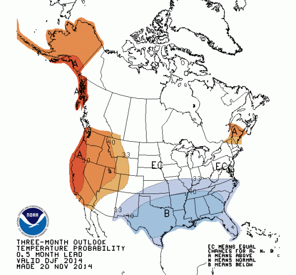
The Climate Prediction Center forecasts warmer than normal conditions from the Rockies to the West Coast. Keep in mind that such long-range forecasts have imperfect skill, analogous to weighting a coin so that heads occurs perhaps 70 percent of the time.

The bottom line prediction for snow lovers?
There will be below-normal snowpack over the Northwest and more precipitation in California than last year, which means more snow in the high Sierras. Colorado will have a normal year. This forecast has imperfect skill, but it is the best we can do at this point.
