With spring blooms, lush summer forests, iconic fall foliage and stark winter beauty, the Boston area’s hiking trails deliver a rich hiking experience, no matter the season. That’s partly thanks to eastern Massachusetts’ surprisingly wide range of geography. Within an hour’s drive of downtown, you’ll find everything from coastal marshes to manicured gardens to rugged summits. Plus organizations such as the Emerald Necklace Conservancy, the Trustees of the Reservations and the city’s Parks and Recreation Department have long worked to protect large swathes of land both inside and adjacent to Boston, for recreation and habitat preservation. As a result, you can choose to stick to the city center or stray a little farther from downtown, but wherever you go, you’ll find thriving landscapes and miles upon miles of trail.
Arnold Arboretum Tour
- Location: 6.4 miles southwest of downtown Boston, MA
- Length: 3.6-mile loop
- Difficulty Rating: Easy
- Best For: An adaptable ramble through Harvard’s arboretum
- Dogs: Leashed
With more than 17,000 individual plants arrayed over 281 acres and a schedule packed with guided tours and educational offerings, the 150-year-old Arnold Arboretum is sure to entertain. Going with family? Stroller- and ADA-accessible paths and an assortment of child-oriented activities will delight your little ones. Looking for skyline views? Snag a bench at the top of Peters Hill and gaze across the treetops to Boston’s skyscrapers. Want to forget you’re in the city? Wander through the tree-lined meadows of the Conifer Collection or follow the Oak Path to sequester yourself beneath the broad boughs of the Oak Collection. To take it all in, start with the Arnold Arboretum Tour, a 3.6-mile loop that hits many of the green space’s highlights.

Conifer Collection (Photo Credit: Plant Image Library under CC BY-SA 2.0).
World’s End Loop
- Location: 1.8 miles northeast of Hingham, MA
- Length: 3.1-mile loop
- Difficulty Rating: Easy
- Best For: Exploring both pastoral countrysides and rocky shores
- Dogs: Leashed
If you’re searching for remote tranquility, try World’s End. Jutting into Hingham Bay, the small peninsula is home to both a wildflower-laden, rolling countryside and a rugged coastline with rocky beaches and tidal marshes. In the 1890s, Frederick Law Olmstead drafted plans for a subdivision in this area, and though the roads were graded and saplings planted, homes were never constructed. Today, this hike traverses an idyllic landscape, taking you along the carriage paths that still meander across the property and beneath massive, mature oaks, maples and pines. Spot the Boston skyline from the crest of Planters Hill or stop by the bird blind to spy the wildlife that frequents the Damde Meadows tidal marsh. There’s an entry fee (unless you’re a Trustees of Reservations member), but the property is open year-round. Shoot for an off-season adventure and you’ll likely have the entire place to yourself.
Halibut Point Loop
- Location: 2.8 miles north of Rockport, MA
- Length: 1.1-mile loop
- Difficulty Rating: Easy
- Best For: An interactive history lesson complete with excellent ocean views
- Dogs: Leashed
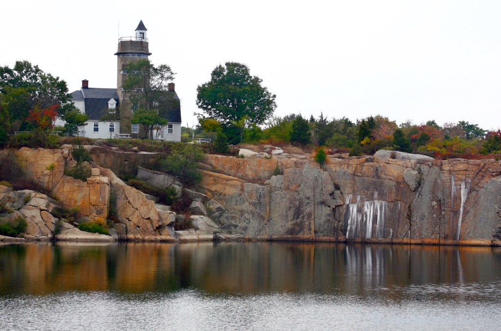
Cape Ann, known for its craggy ocean views, quaint seaside towns and historic fishing industry, has another, lesser-known backstory: granite quarrying. Halibut Point State Park, the location of the 19th-century Babson Farm Quarry, offers a glimpse into this once-thriving industry. Guided and self-guided tours begin from a historic fire control tower perched on the rim of the old, freshwater-filled quarry and explore the region’s cultural and natural history. Interpretive sites detail each step in the arduous granite quarrying process, and the tour’s conclusion involves a stone cutting demonstration. Once you’ve finished touring the quarry, head to the sea shore, where there are granite piles for scrambling and tidepools for exploring. Consider bringing binoculars for the world-class birding and a picnic for the sunset.

Halibut Point lighthouse (Photo Credit: liz west under CC BY 2.0).
Crane Beach Loop
- Location: 5 miles east of Ipswich, MA
- Length: 3.9-mile loop
- Difficulty Rating: Intermediate
- Best For: A hike through dunes and forest paths
- Dogs: Leashed
City residents flock to Crane Beach, a Trustees of Reservations property an hour north of Boston, Massachusetts, for a quintessential beach experience. And sure, you can enjoy a little sunbathing and call it a day, but there’s a substantial trail network just beyond the boardwalks that is well-worth exploring. The well-maintained, well-marked paths meander through pine forest, past marshes and across grass-studded dunes, while occasional spur trails pop down to secluded beaches. This loop takes you along both the north and south sides of the peninsula, treating you to views of the marshy Crane Wildlife Refuge and the Castle Neck River before traversing the sandy dips and hollows along the Atlantic coast. Unfortunately, the bugs can be as infamous as the crowds during the summer, but both are gone in the off-season—plus the entry fee is cheaper and solitude is all but guaranteed.
Dogtown Loop
- Location: 1.8 miles north of Gloucester, MA
- Length: 6.1-mile loop
- Difficulty Rating: Intermediate
- Best For: Exploring some of the stranger remnants of Massachusetts history
- Dogs: Leashed
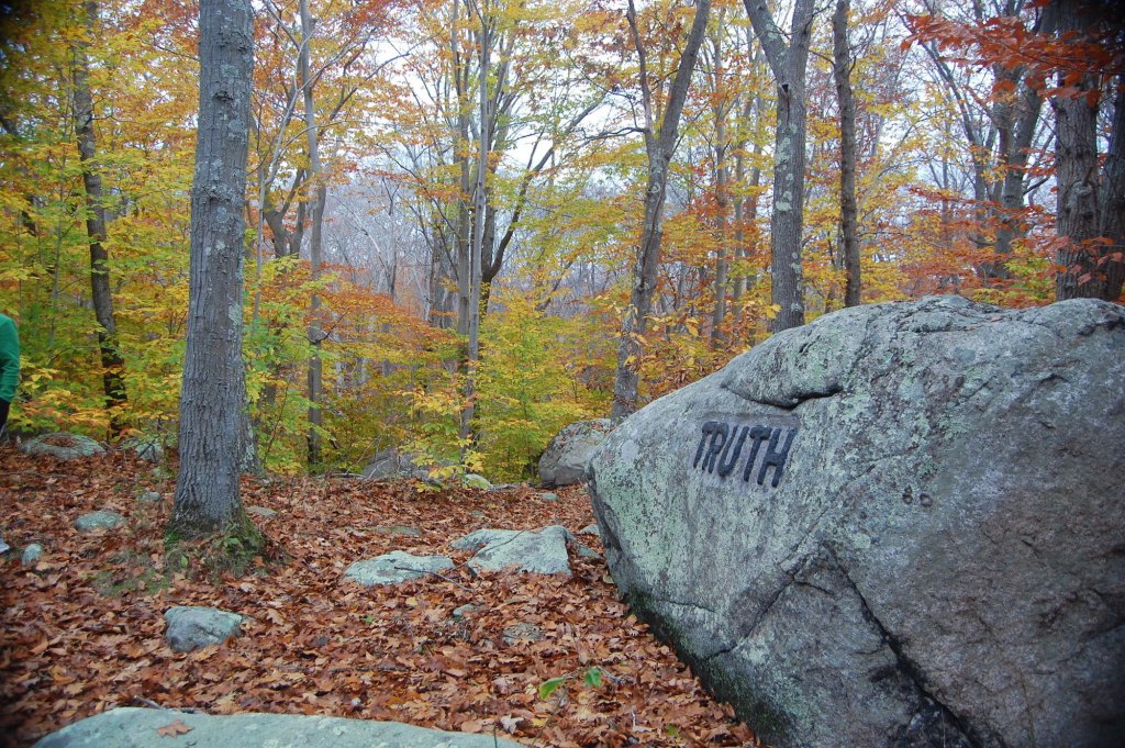
If you’re into odd and eerie places, head to the abandoned settlement of Dogtown, part of the 500-square-mile Essex National Heritage Area. The village was first settled in 1693, but after decades of decline, it was finally abandoned in 1830. Most of the land has once again become wild forest bisected with abandoned roads and new hiking trails, which would normally make this a tranquil spot. However, abundant ghost stories regarding the witches said to inhabit the village during the community’s final days may send a shiver down your spine. And it probably doesn’t help that Dogtown’s trails lack markings and don’t follow any particular logic, meaning it’s all too easy to get lost. But one of the area’s most enduring legacies is actually far more tangible than spooky stories. Scattered throughout the forest are more than thirty boulders deposited by the retreating ice sheet after the last ice age. During the Great Depression, Gloucester’s eccentric, local millionaire, Roger Babson, hired quarrymen to chisel inspirational sayings into the surfaces of the boulders. Now, while hiking Dogtown, you’re still reminded of things such as “Help mother,” “Never try never win” and “Be on time.”

Dogtown Commons (Photo Credit: Ralph.Torello under Public Domain Mark 1.0).
Lynn Woods Loop
- Location: 2.8 miles northwest of Lynn, MA
- Length: 7.0-mile loop
- Difficulty Rating: Intermediate
- Best For: An introduction to the sprawling park and it’s quirky highlights
- Dogs: Leashed
What does it take to stand out in a park home to 2,220 acres, 30 miles of trail and three reservoirs? How about buried treasure. Or at least that’s the legend behind the Lynn Woods Reservation’s Dungeon Rock, a collapsed cave local folklore says is the final resting place of a 17th-century pirate. In the 1850s, the pirate’s ghost purportedly encouraged a man and his family to dig up the loot, to no avail. But the cave they excavated still exists today and is open to the public on a weekly basis (check with the Lynn Woods Ranger for a schedule). If the timing isn’t right for a tour, check out the Lynn Woods Loop which ambles along Walden Pond, past Dungeon Rock and crests Burrill Hill where a stone tower provides views of the Boston skyline.
Rock Circuit Loop
- Location: 7.1 miles north of downtown Boston, MA
- Length: 4.6-mile loop
- Difficulty Rating: Difficult
- Best For: An alternative tour of Middlesex Fells
- Dogs: Leashed
In many ways, Middlesex Fells Reservation is synonymous with its spectacular Skyline Trail, a 7.5-mile singletrack loop known for its views. But the park’s 100-plus-mile labyrinthine trail network holds virtually endless potential for exploration. For a challenge, try the Rock Circuit Loop. The route verges on absurd, seemingly seeking out every possible obstacle, ascending and descending endless rocky piles and slabs. Though tough, this technical trail is perfect for preparing for longer, harder hikes (like those in New Hampshire’s White Mountains). But even if you’re not training, the views of the surrounding cityscape are well worth the effort. Plus, thanks to its location on the east side of the Fells, the circuit is surprisingly easy to access from Boston via public transportation. Hop off the T’s Orange Line at Oak Grove Station and you’re just a 15-minute walk from the reservation.

Middlesex Fells, Medford, United States (Photo Credit: Bonnie Kittle).
